
A Peak District Guide
The Mam Tor Great Ridge Walk is without a doubt one of the finest high-level traverses in the country, offering some of the most spectacular and accessible views in the Peak District National Park. This classic circular route, often starting from the village of Castleton, takes you along an undulating spine that separates the Hope Valley from the Vale of Edale, bagging several iconic summits along the way. It’s a must-do for any UK hiker and a highlight of our recommended Peak District Day Hikes.
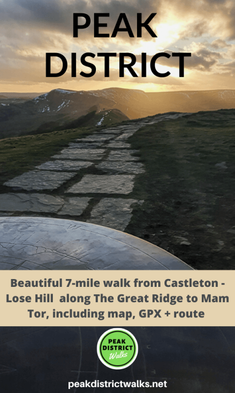
Mam Tor Great Ridge Walk
Voted one of Britain’s favourite walks, this hugely popular Peak District ridge walk delivers dramatic scenery from start to finish. The route’s main attraction is the 517-metre peak of Mam Tor, the ‘Mother Hill’, famous for the landslips on its eastern face that give it the nickname “The Shivering Mountain”. From its summit, the route follows the well-paved Great Ridge eastwards over Hollins Cross, the craggy top of Back Tor, and finally to Lose Hill Pike. The panoramic views are constant and breathtaking, encompassing the Kinder Plateau to the north, the full sweep of the Hope Valley to the south, and the dramatic limestone gorge of Winnats Pass.
This guide details the classic circular Mam Tor Castleton walk, a moderately challenging route that provides a full and rewarding day out. While there are shorter options starting from Mam Nick car park, this longer loop from Castleton allows you to experience the charming village and the dramatic approach through the stunning limestone valley of Cave Dale.
Route Overview and Key Facts
- Route Type: Circular Loop
- Start/Finish Point: Castleton Visitor Centre, Cross Street, Castleton, S33 8WN (Grid Ref: SK 149 829)
- Distance: Approx. 8 miles / 13 km
- Time to Complete: 4–5.5 hours
- Total Ascent: Approx. 550 metres (1,800 ft)
- Highest Point: Mam Tor summit at 517 metres (1,696 ft)
- Key Summits: Lose Hill (476m), Back Tor, Hollins Cross, Mam Tor (517m)
- Ordnance Survey Map: OS Explorer OL1 – The Peak District (Dark Peak Area)
- Terrain: A mix of village lanes, muddy farm tracks, steep stone-pitched steps, and well-maintained flagstone paths. The descent through Cave Dale is on loose, rocky limestone.
Starting Point and Parking at Castleton
The picturesque village of Castleton is the ideal base for this Mam Tor walk. It offers ample facilities and adds a charming start and end to your day. The primary car park is the Castleton Visitor Centre Car Park (postcode S33 8WN). As this is one of the most popular spots in the Peak District, it fills up extremely quickly, especially on weekends and during holidays. An early start is highly recommended to secure a space.
Parking charges (as of early 2025) are typically around £4.00 for 2-4 hours and £6.00 for up to 10 hours, which should be sufficient for the walk. The machines accept coins and card payments, and you can also use the PayByPhone app (location code 806748) to avoid needing change. There are public toilets available at the visitor centre, and a café that opens at 10 am.
Due to significant traffic and parking issues, Derbyshire County Council has proposed new parking restrictions for Castleton, including ‘red routes’ where stopping is prohibited. Before travelling, it’s wise to check the latest information on parking and access from the official Peak District National Park Authority website to avoid any issues.
For those using public transport, the nearest train station is in Hope, approximately 2 miles away. From there, the 271/272 bus service runs to Castleton village, making it a viable car-free option.
Step-by-Step Great Ridge Route Description
This route tackles the ridge in an anti-clockwise direction, ascending Lose Hill first before traversing the ridge to Mam Tor. This saves the iconic summit for the grand finale and offers fantastic views of the ridge stretching out before you.
Stage 1: Castleton to Lose Hill Summit (Approx. 3.5 km)
From the Castleton Visitor Centre, turn left and walk through the village, passing shops and pubs like Ye Olde Cheshire Cheese Inn. Follow the road as it bends, and just after crossing a small bridge, cross the road to find a footpath signposted up a track. This path leads you past the YHA Castleton Losehill Hall. Go through a stile into a field and follow the path as it gradually climbs uphill across farmland. The route involves crossing a few more stiles and a small wooden bridge. Follow the fingerposts for ‘Lose Hill’. The final section is a steep, grassy climb up a rocky footpath that brings you to the stone marker at the summit of Lose Hill (476m). The views open up here, giving you the first taste of the stunning panoramas to come.
Stage 2: The Great Ridge – Lose Hill to Mam Tor (Approx. 3.4 km)
This is the heart of the Great Ridge walk. From Lose Hill summit, the route is clear and easy to navigate. Follow the well-maintained flagstone path as it descends from Lose Hill and undulates along the ridge. Your next objective is the craggy top of Back Tor. The path climbs to its summit, from where the views back along the ridge to Lose Hill and forward to Mam Tor are magnificent. The descent from Back Tor is the trickiest part of the ridge; it’s a short but steep and rocky section, so take your time.
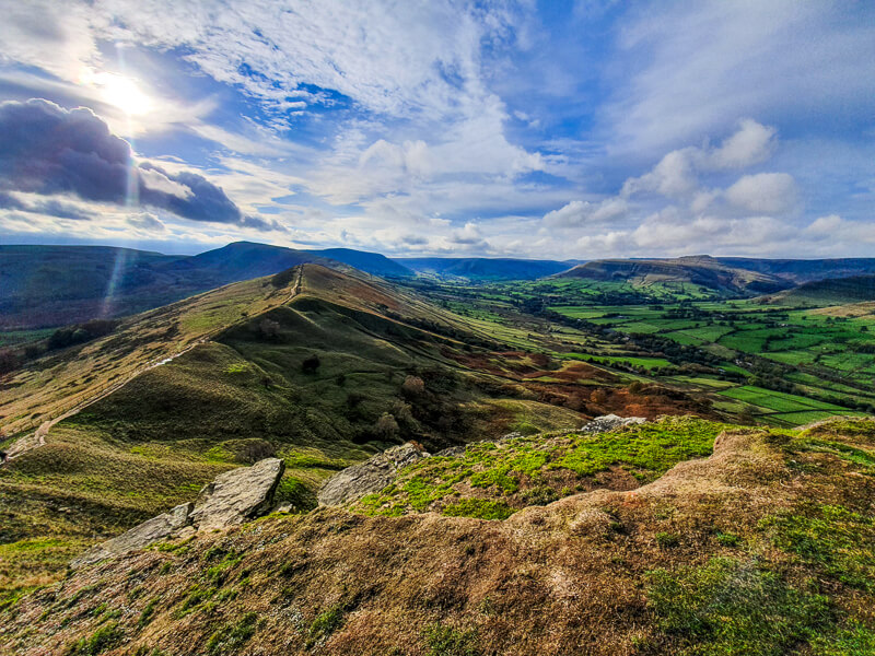
Once down from Back Tor, continue along the flagstones until you reach Hollins Cross, the lowest point on the ridge and a major junction of footpaths. A memorial here commemorates walker Tom Hyett. From Hollins Cross, your final ascent begins. Continue straight ahead, following the stone-pitched path that climbs steadily up the flank of Mam Tor. After passing through a couple of gates, a final series of stone steps leads you directly to the trig point marking the summit at 517 metres. Here, you’re rewarded with 360-degree views over the entire area, including the remnants of an Iron Age hill fort.
Stage 3: Descent via Cave Dale to Castleton (Approx. 4 km)
From the Mam Tor trig point, continue over the summit and begin your descent down the stone steps on the other side. Instead of taking the direct path back towards the road, this route offers a more dramatic and scenic return via Cave Dale. Follow paths that lead you across the fields towards the road near Winnats Head Farm. Cross the road and pick up the footpath that descends into the head of Cave Dale.
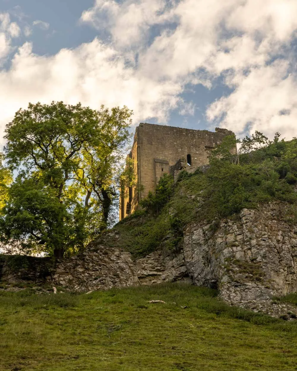
This section is utterly magical. You will be walking through a deep, dry limestone valley with steep cliffs rising on either side. The path is made of loose, uneven rocks and can be slippery when wet, so careful footing is required. As you descend, the magnificent ruin of Peveril Castle appears perched dramatically above you on the right, creating a fairytale-like scene. The 700-metre section through the gorge is over all too quickly and leads you directly back into the heart of Castleton, just a short walk from the visitor centre and a well-earned pub lunch.
Difficulty, Exposure and Terrain
This Mam Tor Great Ridge Walk is generally considered a moderately challenging route. While it doesn’t involve any scrambling, the total distance and ascent require a good level of fitness. The terrain is highly varied. You’ll encounter paved village lanes, grassy fields that can become very muddy after rain, and well-surfaced flagstone paths along the majority of the ridge. However, there are also steep sections of stone steps, particularly on the final ascent to Mam Tor, and the descent from Back Tor is on a short, rocky path. The most challenging terrain underfoot is the descent through Cave Dale, which is on loose, slippery limestone rocks and requires concentration and sturdy footwear.
The key characteristic of this walk is its exposure. The Great Ridge is an exposed, high-level path. There is very little shelter from the elements. Wind speeds can be significantly higher and temperatures much lower than in the valley below. Even on a calm, sunny day in Castleton, be prepared for windy conditions on the ridge. This exposure is what provides the incredible views, but it’s also a critical safety consideration.
Safety, Weather and Ridge Walking Advice
Safety should always be your priority. The Peak District’s weather is notoriously changeable, and conditions on an exposed Peak District ridge walk can deteriorate rapidly. Before you set off, always check a reliable mountain weather forecast, such as the Met Office or the Mountain Weather Information Service (MWIS) for the Peak District. Pay attention to wind speed, wind chill (‘feels like’ temperature), and visibility. A sunny day can quickly turn to thick cloud, making navigation difficult.
Carrying the right kit is essential for both safety and comfort. Do not underestimate the conditions. Essential gear includes:
- Footwear: Sturdy, waterproof hiking boots with good grip are essential for the varied and potentially slippery terrain.
- Clothing: Wear layers you can add or remove. A moisture-wicking base layer, a fleece mid-layer, and a fully waterproof and windproof jacket and trousers are non-negotiable.
- Warmth: Always pack a hat and gloves, even in summer. The wind on the ridge can be biting.
- Navigation: While the path is often clear, you must carry a map (OS Explorer OL1) and compass and know how to use them. A GPS device or a phone with a mapping app (and a power bank) is a great backup.
- Safety Gear: A small personal first-aid kit, a whistle (six blasts for help), and a head torch with spare batteries are vital in case of an emergency.
- Food and Water: Carry at least 1-2 litres of water and plenty of high-energy snacks. There are no facilities on the route itself.
In an emergency, if you need assistance on the hills, dial 999, ask for the Police, and then state that you require Mountain Rescue. Be ready to provide your exact location (a grid reference or What3Words is ideal), the number of people in your group, and the nature of the incident. The volunteer teams of Mountain Rescue England and Wales are on call 24/7. You can also register for the emergency SMS service by texting ‘register’ to 999 before your trip.
Finally, respect the environment you are walking in. The area around Mam Tor is managed by the National Trust. Stick to the paths to prevent erosion, take all your litter home, and keep dogs on a lead, as you will likely encounter livestock and there are steep cliff edges. Following the Countryside Code ensures these beautiful places remain for everyone to enjoy.
The Mam Tor Great Ridge Walk is a truly classic hike that lives up to its reputation. With proper preparation, it offers an unforgettable day of stunning views and rewarding hiking. If you’ve enjoyed this route, you might also want to explore another Peak District classic, the Dovedale Stepping Stones Walk, for a beautiful riverside adventure.
