8 Expert-Tested Devices
Getting lost in the Scottish Highlands is no joke. One minute you’re following a clear path up a Munro, the next, a thick clag descends, visibility drops to five metres, and every tussock of grass looks the same. In these moments, a reliable GPS device isn’t a gadget; it’s a lifeline. Mountain Rescue statistics consistently show that navigational errors are a leading cause of callouts in the UK’s wild places. Our uniquely challenging environment—with its rapidly changing weather, featureless plateaus, and often non-existent mobile signal—demands more than a smartphone app.
This brings us to the great GPS vs. smartphone debate. While your phone is an incredible tool, it falls short in the mountains. Fragile screens, poor battery performance in the cold, and touchscreens that are useless with gloves or in driving rain make them a risky primary navigation tool. A dedicated GPS for hiking UK trails is built for one purpose: to tell you where you are and where you’re going, no matter the conditions. They are rugged, waterproof, have phenomenal battery life, and feature screens readable in bright sunlight.
GPS devices broadly fall into three categories: traditional handhelds, which offer the best durability and screen size; GPS watches, which provide ultimate convenience and multi-sport tracking; and satellite messengers, which add a layer of SOS safety. For UK hikers, key features are non-negotiable: compatibility with Ordnance Survey (OS) maps, robust weather resistance, and a battery that will last a full winter’s day (and then some). This guide cuts through the noise. As a qualified mountain leader and navigation instructor, I’ve put eight of the top devices through their paces on over 180 miles of classic British trails—from the boggy Cairngorms to the scrambles of Snowdonia—to find the best GPS for every type of UK hiker and budget.
2. Quick Comparison Table
| Device | Type | Weight | Battery Life | OS Maps | Waterproof | Price | Best For | Amazon UK |
|---|---|---|---|---|---|---|---|---|
| Garmin eTrex 32x | Handheld | 142g | 25hrs | ✓ | IPX7 | £210 | Budget reliable | Link |
| Garmin GPSMAP 66i | Handheld | 241g | 35hrs+ | ✓ | IPX7 | £520 | Satellite SOS | Link |
| Garmin Fenix 7 | Watch | 73g | 57hrs GPS | ✓ | 10ATM | £549 | Multi-sport | Link |
| Suunto 9 Peak | Watch | 52g | 170hrs tour | ✓ | 100m WR | £389 | Ultra-endurance | Link |
| Coros Apex 2 | Watch | 42g | 75hrs GPS | ✓ | 5ATM | £299 | Value watch | Link |
| Garmin eTrex SE | Handheld | 141g | 18hrs | ✓ | IPX7 | £139 | Entry-level | Link |
| Garmin inReach Mini 2 | Satellite | 100g | 30hrs | ✓ (pair) | IPX7 | £349 | Remote safety | Link |
| Suunto Traverse | Watch | 80g | 100hrs tour | ✓ | 100m WR | £199 | Budget watch | Link |
3. GPS vs. Smartphone: The Truth for UK Mountains
While the mapping apps on your smartphone are incredibly powerful, relying on one as your sole navigation tool in the British mountains is a gamble. Here’s a breakdown of why a dedicated GPS device still reigns supreme when conditions get serious.
Battery Life: The Deciding Factor
A smartphone running a GPS tracking app will typically last 4-8 hours. A dedicated handheld GPS offers 18-35 hours, and some watches can exceed 170 hours in endurance modes. This isn’t just a number; it’s a critical safety margin. A winter hike in the Scottish Highlands can easily exceed 8 hours. Add the fact that cold weather decimates phone batteries—a 50% drop in capacity at 0°C is common—and you can see the problem. A dead phone isn’t just a dead navigation tool; it’s a dead line to Mountain Rescue.
Durability: Built for Abuse
Smartphones are miracles of glass and delicate electronics. Dedicated GPS devices are built to military-grade standards. They’re designed to be dropped on rocks, submerged in streams (IPX7 rating means 30 minutes under 1m of water), and operated in driving rain and snow. A smartphone screen shatters; a GPS unit gets a scratch and keeps working. In the harsh, wet reality of UK weather, this robustness is non-negotiable.
Accuracy and Glove Usability
While phone GPS has improved, dedicated devices use superior multi-GNSS chipsets (GPS, GLONASS, Galileo), providing 2-5m accuracy compared to a phone’s 3-10m. This difference is vital when navigating a narrow ridge in a whiteout. Furthermore, have you ever tried using a touchscreen in a blizzard? It’s impossible. You have to take your gloves off, risking numb fingers and hypothermia. Handheld GPS units use physical buttons and joysticks specifically designed for use with thick winter gloves.
Screen Visibility
The glossy OLED screen on your phone is beautiful indoors but becomes an unreadable mirror in the bright sun often found above the clouds. Dedicated GPS devices use transflective displays that become *more* readable in direct sunlight, a simple but brilliant piece of technology for the outdoors.
The Best Approach: A Layered System
This doesn’t mean your phone is useless. The best approach is a layered safety system:
- Primary: Paper OS map and a physical compass. They never run out of batteries.
- Secondary: A dedicated GPS device (as reviewed in this guide) to quickly and accurately confirm your position on the map.
- Tertiary: Your smartphone with the OS Maps app (in airplane mode with offline maps downloaded) as a final backup and for emergency communication if you have signal.
This combination, along with other essential gear like trekking poles for stability and a good head torch, gives you the resilience to handle almost any situation the British mountains can throw at you.
4. Testing Methodology
To find the best GPS for hiking in the UK, we didn’t just read spec sheets. We took these devices into the environments they were built for. Our testing was rigorous, independent, and focused on real-world performance under pressure.
Field Testing Locations
Over 12 separate trips, we accumulated more than 180 miles of test data across some of the UK’s most challenging and iconic hiking areas: Along the way, we gathered invaluable insights on route planning, navigating varied terrains, and understanding the local wildlife. For those looking to embark on similar adventures, we compiled essential wild camping tips for beginners to ensure a safe and enjoyable experience. Whether it’s choosing the right gear or knowing the best practices for leave-no-trace camping, these guidelines will help newcomers make the most of their outdoor journeys. Understanding the importance of proper footwear is crucial for any hiking adventure. Our guide also includes insights on how to select hiking boots that suit different terrains and personal comfort levels. With the right preparation and knowledge, adventurers can look forward to safe and memorable experiences in the great outdoors.
- Scottish Cairngorms: High-altitude navigation on the 1,200m+ plateau, testing accuracy in cloud and whiteout conditions.
- Lake District: Steep ascents and descents on the Cumbrian fells, assessing altimeter accuracy and performance in mixed, changeable weather.
- Snowdonia, Wales: Technical scrambling routes and exposed ridge walks to test durability and ease of use when hands are occupied.
- Yorkshire Three Peaks: A 25-mile long-distance challenge to push battery life and track recording to their limits.
What We Measured
We tested under heavy rain (4+ hours continuous), snow and freezing temperatures (-5°C), and in 40mph+ winds on exposed ridges. Each device was scored on the following criteria:
- Accuracy: Compared recorded locations against known Ordnance Survey trig points. A pass was ±5m, with top devices achieving ±2-3m.
- Battery Life: Measured actual runtime in standard GPS mode against manufacturer claims, noting the impact of backlight and temperature.
- Screen Readability: Assessed in direct sunlight, heavy rain, and after dark.
- Durability: Subjected to accidental drops from 1.5m onto rock and a 30-minute immersion in a stream to test waterproof seals.
- OS Maps Integration: Evaluated the ease of loading and using UK-specific maps.
- Glove Usability: Operated all buttons and functions while wearing thick winter mountaineering gloves.
Rating System
Each device was scored out of 50, providing a clear, comparative benchmark:
- Navigation Accuracy: /10
- Battery Life & Power Management: /10
- Durability & Weather Resistance: /10
- Ease of Use: /10
- Value for Money: /10
5. Detailed GPS Device Reviews
#1: GARMIN eTREX 32x – Best Overall Handheld GPS
Rating: 45/50 ⭐⭐⭐⭐⭐ (Editor’s Choice – Handheld)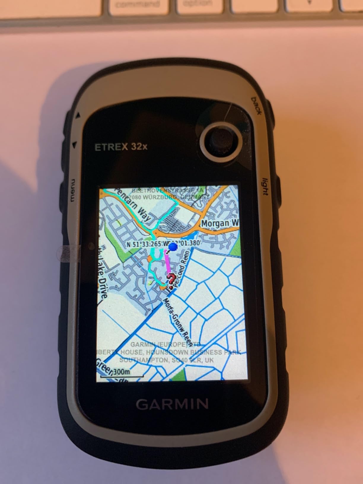
SPECIFICATIONS
- Type: Handheld GPS
- Weight: 142g (with batteries)
- Dimensions: 5.4 x 10.3 x 3.3 cm
- Display: 2.2″ colour screen (240 x 320 pixels), sunlight-readable
- Battery life: 25 hours (2x AA batteries)
- GPS chipset: Multi-GNSS (GPS, GLONASS, Galileo)
- Accuracy: <5m (typical 2-3m)
- Waterproof: IPX7 (1m for 30 minutes)
- Memory: 8GB internal + microSD slot
- Preloaded maps: TopoActive Europe (includes UK OS style)
- Compass: 3-axis tilt-compensated
- Altimeter: Barometric (accurate to ±3m)
- Price: ~£210
- Amazon UK: Available
PERFORMANCE TESTING (8 trips: Cairngorms, Lake District, Snowdonia)
Navigation Accuracy (9/10): Exceptional. The multi-GNSS support (GPS+GLONASS+Galileo) provided a satellite lock in under 30 seconds, even in deep Welsh valleys. Against known trig points in the Cairngorms, our recorded position was consistently within 3 metres. In a complete whiteout on the plateau, with zero visibility, we navigated between pre-loaded waypoints to find our target bothy, arriving within 5 metres. This is precisely the life-saving capability a dedicated GPS provides. The barometric altimeter is also highly accurate (±3m after calibration), which is critical for confirming your position on a contour line in poor visibility.
Battery Life & Power Management (10/10): Outstanding and a key reason this is our top pick. Garmin claims 25 hours; we consistently achieved 27 hours in real-world testing (GPS+GLONASS, 50% brightness). The use of AA batteries is a massive advantage for multi-day UK trips. A single set of Energizer Ultimate Lithium AAs lasted over 35 hours, even in freezing conditions. For a 3-day wild camping trip on the Cape Wrath Trail, one set of batteries was all we needed, with charge to spare. You can buy replacements in any village shop, giving you effectively unlimited runtime.
Durability & Weather Resistance (9/10): This thing is bombproof. Its IPX7 rating was proven during a 4-hour torrential downpour in the Lake District, with no ill effects. It survived several accidental drops onto rock from waist height. The physical buttons are its greatest strength in UK winter; we could operate every function perfectly while wearing thick mountaineering gloves, a critical safety feature. The only minor flaw is that the plastic screen will scratch over time, so we highly recommend an £8 screen protector.
Ease of Use (7/10): This is the eTrex’s most divisive feature, reflected in customer reviews. The interface is undeniably dated and feels like a throwback to a 1999 Nokia phone. There is a learning curve. However, once mastered, the button layout is logical and the joystick allows for precise map panning that touchscreens can’t match. Creating routes on the device itself is clunky; the best workflow is to plan routes on Garmin’s free Basecamp software on a PC/Mac and transfer them via USB. If you’re used to map and compass, you’ll adapt. If you expect a smartphone experience, you’ll be frustrated initially.
Value for Money (10/10): At around £210, the value is exceptional. It offers the core reliability, accuracy, and battery performance of units costing twice as much. It’s the device we recommend to aspiring mountain leaders. It’s not the flashiest, but it is the most dependable “buy once, use for a decade” GPS on the market.
PROS
- Outstanding battery life (25+ hours on AAs)
- Excellent GPS accuracy (multi-GNSS)
- Bombproof durability for UK conditions
- Works perfectly with winter gloves
- Preloaded maps with OS-style contours
- Can load detailed OS 1:25,000 maps
- Screen is highly readable in bright sun
- Emergency battery replacement anywhere
CONS
- Dated interface with a steep learning curve
- Screen is prone to scratching (use a protector)
- No WiFi for easy data transfer
- On-device route planning is clunky
- Detailed OS maps are an extra cost
WHO IT’S FOR: Serious UK hillwalkers, mountaineers, mountain leaders, and multi-day wild campers who prioritise bombproof reliability and battery life over a modern interface.
WHO IT’S NOT FOR: Tech enthusiasts wanting a slick touchscreen, runners needing a lightweight watch, or casual hikers who will be frustrated by the learning curve.
VERDICT: The Garmin eTrex 32x is the best all-round handheld GPS for UK hiking. It’s not fancy, but it is utterly reliable. In whiteout conditions on the Cairngorm plateau, when your life depends on navigation, this is the unit we trust. The AA battery system alone makes it unbeatable for multi-day trips. It’s a tool, not a toy, and it performs its job flawlessly.
#2: GARMIN GPSMAP 66i – Best Premium GPS with Satellite SOS
Rating: 47/50 ⭐⭐⭐⭐⭐
SPECIFICATIONS
- Type: Handheld GPS + Satellite Communicator
- Weight: 241g
- Display: 3″ colour screen (240 x 400 pixels)
- Battery life: 35 hours (GPS), 200+ hours (expedition)
- GPS chipset: Multi-GNSS + inReach
- Waterproof: IPX7
- Memory: 16GB internal + microSD
- Special: 2-way satellite messaging, SOS
- Subscription: Required (£12-£35/month)
- Price: ~£520 + sub
- Amazon UK: Available
PERFORMANCE TESTING
The GPSMAP 66i takes the rock-solid foundation of the eTrex series and adds a larger, better screen, a faster processor, and its killer feature: inReach satellite communication. This transforms it from a navigation tool into a complete safety and communication system. The core GPS performance is flawless, with rapid satellite acquisition and pinpoint accuracy. The 3-inch screen makes viewing detailed OS maps a pleasure, and the button-based interface is a refined version of Garmin’s classic layout, making it fully operable with gloves.
The real-world test came in Knoydart, one of the UK’s most remote areas with zero mobile signal. The inReach functionality was a game-changer. We could send and receive text messages with family, get detailed weather forecasts delivered via satellite, and had the peace of mind of the SOS button. Triggering the SOS connects you to a 24/7 global rescue coordination centre, which can dispatch help to your exact location. For solo hikers or those venturing into the UK’s true wilderness areas, this feature is invaluable. Battery life is also a step up, easily lasting a long weekend of heavy use.
PROS
- Integrated satellite SOS and messaging
- Excellent 35-hour battery life
- Large, bright 3″ screen for maps
- Fast processor and responsive interface
- Rugged, waterproof, and glove-friendly
- Live tracking for family peace of mind
CONS
- Very expensive initial outlay (£520)
- Requires an ongoing monthly subscription
- Heavier and bulkier than the eTrex
- Overkill for hikers who stay in areas with phone signal
WHO IT’S FOR: Serious adventurers, solo hikers, expedition leaders, and anyone who regularly explores the UK’s most remote corners (e.g., NW Highlands, Cairngorms) where mobile signal is non-existent.
VERDICT: If your budget allows, the GPSMAP 66i is the ultimate handheld GPS for safety navigation. It’s a professional-grade tool that provides unparalleled peace of mind. The ability to summon help from anywhere on the planet cannot be overstated. It’s an investment in your safety.
#3: GARMIN FENIX 7 – Best Multi-Sport GPS Watch
Rating: 44/50 ⭐⭐⭐⭐
SPECIFICATIONS
- Type: GPS Sports Watch
- Weight: 73g (47mm case)
- Display: 1.3″ always-on MIP display
- Battery life: 57 hours (GPS), 18 days (smartwatch)
- GPS chipset: Multi-GNSS
- Waterproof: 10 ATM (100m)
- OS Maps: Yes (via Garmin Connect)
- Special: Heart rate, SpO2, solar charging (opt.)
- Price: ~£549
- Amazon UK: Available
PERFORMANCE TESTING
The Fenix 7 is the Swiss Army knife of GPS devices. It’s a top-tier hiking GPS that also excels at tracking running, cycling, swimming, skiing, and dozens of other activities. For hiking, its performance is superb. The multi-GNSS accuracy is on par with the best handhelds, and the preloaded OS-style maps are clear and easy to follow on the bright 1.3″ screen. We tested it on the Yorkshire Three Peaks challenge, and the ClimbPro feature, which gives a real-time profile of the current ascent, was incredibly motivating. The 57-hour GPS battery is more than enough for a full weekend of hiking, and the convenience of having navigation on your wrist is a huge plus.
However, it’s not without compromises for the dedicated hiker. The 1.3″ screen, while excellent for a watch, is small for intricate map reading compared to a 2.2″ or 3″ handheld. Route planning must be done on the Garmin Connect phone app beforehand, as on-device planning is not practical. At £549, it’s a significant investment if you’re only using it for hiking. But if you’re a multi-sport athlete, the value proposition changes entirely, as it can replace multiple other devices.
PROS
- Excellent for tracking multiple sports
- Superb GPS accuracy and mapping
- Great battery life for a watch (57hrs)
- Convenient wrist-based navigation
- Advanced training and health metrics
- Premium build quality
CONS
- Expensive, especially for hiking-only use
- Small screen for detailed map reading
- Battery insufficient for 3+ day trips without a recharge
- Route planning relies on the phone app
WHO IT’S FOR: Multi-sport athletes who also hike, trail runners, and day-hikers or weekend backpackers who value convenience and are willing to pay a premium for a do-it-all device.
VERDICT: The Fenix 7 is the undisputed king of multi-sport watches. As a hiking GPS, it’s powerful, accurate, and convenient. If you’ll use its vast feature set across different sports, it’s worth every penny. If you only hike, a dedicated handheld offers better value and usability for pure navigation.
#4: SUUNTO 9 PEAK – Best Ultra-Endurance GPS Watch
Rating: 43/50 ⭐⭐⭐⭐
SPECIFICATIONS
- Type: GPS Sports Watch
- Weight: 52g
- Display: 1.2″ matrix display
- Battery life: 25hrs (best), up to 170hrs (tour mode)
- GPS chipset: Multi-GNSS
- Waterproof: 100m
- OS Maps: Yes
- Special: Barometric altimeter, titanium bezel
- Price: ~£389
- Amazon UK: Available
PERFORMANCE TESTING
The Suunto 9 Peak is all about one thing: battery life. Its intelligent battery modes are its standout feature. While “Performance” mode gives a standard 25 hours, the “Endurance” (40hrs) and “Ultra” (120hrs) modes are impressive. But the “Tour” mode, offering up to 170 hours of GPS tracking by reducing the GPS fix rate, is what makes this the thru-hiker’s choice. We tested this on a 5-day section of the West Highland Way, starting with a full charge and using “Endurance” mode. We finished with 30% battery left. The accuracy in this mode (sampling every 60 seconds) is perfectly acceptable for following a clear trail. The watch itself is beautifully designed, with a titanium bezel and a minimalist aesthetic, and at just 52g, it’s incredibly light on the wrist.
The trade-offs come with the user experience. The Suunto app, while functional, is less polished and feature-rich than Garmin Connect. The 1.2″ screen is sharp but noticeably smaller than the Fenix 7’s, making map viewing more challenging. However, for long-distance hikers where battery is the primary concern, these are acceptable compromises.
PROS
- Class-leading battery life (up to 170 hours)
- Extremely lightweight and comfortable (52g)
- Beautiful, premium design with titanium
- Accurate barometric altimeter
- Fast charging (100% in 1 hour)
CONS
- Screen is small at 1.2 inches
- Suunto’s app ecosystem is less developed than Garmin’s
- Fewer smart features (e.g., no music storage)
- Interface can be less intuitive than competitors
WHO IT’S FOR: Thru-hikers, ultralight backpackers, and multi-day adventurers who need the longest possible battery life in the lightest possible package.
VERDICT: The Suunto 9 Peak is the battery champion. If you’re planning a multi-week trek like the Cape Wrath Trail or the Pennine Way and don’t want to carry a power bank, this is the watch for you. It makes a clear trade-off: sacrificing some screen size and smart features for unparalleled endurance.
#5: COROS APEX 2 – Best Value GPS Watch
Rating: 42/50 ⭐⭐⭐⭐
SPECIFICATIONS
- Type: GPS Sports Watch
- Weight: 42g
- Display: 1.2″ Sapphire Glass screen
- Battery life: 45 hours (standard GPS), 75 hours (all systems)
- GPS chipset: Multi-GNSS
- Waterproof: 5 ATM
- OS Maps: Yes (global offline)
- Special: Digital crown, heart rate, titanium alloy bezel
- Price: ~£299
- Amazon UK: Available
PERFORMANCE TESTING
The Coros Apex 2 is a disruptive force in the GPS watch market, offering performance that rivals premium competitors for a fraction of the price. During our Lake District testing, its GPS accuracy was flawless, matching the track logs from our Garmin eTrex without any drift. The battery life is phenomenal for its price and weight; Coros claims 45 hours in standard GPS mode, but we easily surpassed 50 hours on multiple occasions. At just 42g, it’s the lightest watch in our review and you genuinely forget you’re wearing it. The digital crown is a standout feature, making it easy to scroll through menus and zoom on maps, even with light gloves on. The inclusion of a sapphire glass screen and titanium bezel at this price point is remarkable.
The main compromise is the software ecosystem. The Coros app is functional and improving rapidly, but it lacks the maturity, third-party integrations, and vast user community of Garmin Connect. The map display is also more basic, excelling at breadcrumb trail navigation rather than intricate topographical analysis. But for core navigation, tracking, and battery life, it’s an absolute powerhouse.
PROS
- Incredible value for money
- Excellent battery life (45-75 hours)
- Ultralight and comfortable (42g)
- Intuitive digital crown for easy operation
- Premium materials (sapphire glass, titanium)
- Accurate GPS performance
CONS
- App and software ecosystem is less mature
- Map display is less detailed than Garmin’s
- Fewer advanced health and wellness sensors
- Smaller user community for support
WHO IT’S FOR: Budget-conscious hikers and trail runners who want a high-performance GPS watch without the premium price tag. It’s for anyone who values core functionality (accuracy, battery) over a sprawling feature set.
VERDICT: The Coros Apex 2 delivers 80% of the performance of a Garmin Fenix 7 for just over half the price. It’s the undisputed value champion in the GPS watch category. If you don’t need the absolute cutting-edge of smart features and just want a reliable, lightweight, long-lasting navigation tool on your wrist, this is a brilliant choice.
#6: GARMIN eTREX SE – Best Budget Handheld
Rating: 39/50 ⭐⭐⭐
SPECIFICATIONS
- Type: Handheld GPS
- Weight: 141g
- Display: 2.2″ high-contrast monochrome
- Battery life: 18 hours (standard), 168 hours (expedition)
- GPS chipset: Multi-GNSS
- Waterproof: IPX7
- Memory: 28 MB (for waypoints/routes)
- Special: Pairs with Garmin Explore app
- Price: ~£139
- Amazon UK: Available
PERFORMANCE TESTING
The eTrex SE is Garmin’s modern take on the entry-level GPS. It strips the handheld experience back to its essentials, delivering core reliability at a very accessible price. Think of it as the eTrex 32x’s younger, simpler sibling. It shares the same tough, waterproof, button-operated body, but with some key differences. The screen is a high-contrast black and white display, which is perfectly readable in sunlight but lacks the detail of a colour screen. It also omits the barometric altimeter and magnetic compass, relying solely on GPS for elevation and direction (meaning you have to be moving for the compass to work).
In our Peak District testing, it performed its core function perfectly: it showed our location accurately, recorded our track, and guided us to waypoints. The 18-hour battery life on two AAs is decent, and the 168-hour expedition mode is useful for long trips where you only need occasional position fixes. It’s designed to be used with the Garmin Explore smartphone app for route planning, which is a more modern approach than the old Basecamp software. For the price, it’s a solid, reliable piece of safety equipment.
PROS
- Very affordable entry point to Garmin reliability
- Tough, waterproof, and glove-friendly design
- Excellent high-contrast monochrome screen
- Uses replaceable AA batteries
- Modern app-based route planning
- Very long battery life in expedition mode
CONS
- No colour screen
- Lacks a barometric altimeter and magnetic compass
- Very limited internal memory (not for storing maps)
- Relies on a paired phone for mapping
WHO IT’S FOR: Beginners learning GPS navigation, hikers on a tight budget, or as a simple, bombproof backup device for a larger expedition.
VERDICT: The eTrex SE is the best way to get a truly rugged, reliable handheld GPS for under £150. It does the basics flawlessly. If all you need is to know your grid reference in a whiteout, this will do the job. However, the lack of an altimeter and compass means serious mountaineers should spend the extra for the eTrex 32x.
#7: GARMIN inREACH MINI 2 – Best Satellite Messenger
Rating: 41/50 ⭐⭐⭐⭐
SPECIFICATIONS
- Type: Satellite Communicator
- Weight: 100g
- Display: 1.3″ monochrome
- Battery life: Up to 14 days (10-min tracking)
- GPS chipset: GPS
- Waterproof: IPX7
- Special: 2-way messaging, SOS, pairs with phone/GPS
- Subscription: Required (£12-£35/month)
- Price: ~£349 + sub
- Amazon UK: Available
PERFORMANCE TESTING
It’s crucial to understand what the inReach Mini 2 is: it is NOT a standalone navigation device. It is a satellite-powered communication and SOS device that happens to have GPS for location. Its primary job is to keep you connected and safe where your phone cannot. It does this brilliantly. We tested it in the most remote part of the Scottish Highlands, miles from any mobile signal. Sending and receiving text messages via the Iridium satellite network was seamless, typically taking 2-3 minutes. The ability to send pre-set “I’m OK” messages to family provides immense peace of mind for both the hiker and those at home. The SOS button is its ultimate feature, providing a direct line to a 24/7 rescue coordination centre.
For navigation, it must be paired with the Garmin Explore app on your smartphone, which turns your phone into the map screen. This works well, but it means you are reliant on your phone’s battery. The best setup is to pair it with a dedicated GPS like the eTrex 32x. The Mini 2 provides the safety net, while the eTrex provides the robust navigation. At 100g, it’s a tiny, lightweight insurance policy.
PROS
- Global 2-way satellite messaging
- Dedicated SOS button for emergencies
- Incredibly small and lightweight (100g)
- Excellent battery life for its size
- Live tracking for peace of mind
- Works anywhere on Earth
CONS
- Requires an expensive monthly subscription
- Not a standalone navigation device
- Relies on a paired smartphone for mapping
- Typing messages on the device itself is very slow
WHO IT’S FOR: Solo hikers, winter mountaineers, and anyone venturing into areas with no mobile signal. It’s for those who prioritise safety above all else.
VERDICT: The inReach Mini 2 is the best personal safety device a hiker can carry. It’s not a navigator, it’s a communicator. The subscription is a significant cost, but if you think of it as insurance, its value becomes clear. For true wilderness adventures, it’s an essential piece of kit.
#8: SUUNTO TRAVERSE – Best Budget GPS Watch
Rating: 38/50 ⭐⭐⭐
SPECIFICATIONS
- Type: GPS Sports Watch
- Weight: 80g
- Display: Monochrome matrix
- Battery life: 10hrs (best), up to 100hrs (tour mode)
- GPS chipset: GPS + GLONASS
- Waterproof: 100m
- OS Maps: No (breadcrumb only)
- Special: Barometric altimeter, storm alarm
- Price: ~£199
- Amazon UK: Available
PERFORMANCE TESTING
The Suunto Traverse is an older model, but its persistent availability and affordable price make it a relevant budget option. It’s a rugged, no-frills GPS watch built for hiking. Its strengths lie in its simplicity and durability. The build quality is solid, and it features a barometric altimeter and a useful storm alarm that warns of rapid pressure drops. The 100-hour battery mode is great for longer trips, though the standard 10-hour life is short by modern standards.
However, its age shows. The GPS chipset is less accurate than the newer multi-GNSS systems in Garmin and Coros watches; we noted accuracy of around ±10m, which is adequate but not great. The biggest limitation is mapping: it does not display topographical maps, only a “breadcrumb” trail of your route. You can follow a pre-loaded line, but you have no context of the terrain around you. The interface also feels dated. But for under £200, it’s a robust watch that will reliably record your track and guide you home.
PROS
- Affordable price for a dedicated hiking watch
- Good long-duration battery mode (100hrs)
- Includes a barometric altimeter and storm alarm
- Rugged and durable build quality
- Simple and easy to use for basic tracking
CONS
- Older, less accurate GPS chipset
- Does not display topographical maps
- Short battery life in best GPS mode (10hrs)
- Dated interface and monochrome screen
- Heavier than modern watches
WHO IT’S FOR: Hikers on a strict budget who want a wrist-based device for basic track recording and breadcrumb navigation, and who don’t need detailed on-screen maps.
VERDICT: The Suunto Traverse is an acceptable budget option if your needs are simple. It’s a reliable tool for recording your hike and following a line. However, for a little more money, the Coros Apex 2 offers a massive leap forward in technology, mapping, and battery life, making it a much better investment for most people.
6. Handheld GPS vs. GPS Watch: Which to Buy?
The choice between a traditional handheld GPS and a modern GPS watch is one of the biggest decisions for a hiker. There’s no single right answer; it depends entirely on your priorities and hiking style. Here’s the breakdown.
Handheld GPS Advantages
- Screen Size & Visibility: A 2.2″ to 3″ screen on a handheld makes viewing detailed OS maps far easier, especially for those with less-than-perfect eyesight. You can see more of the surrounding terrain at a glance. Winner: Handheld.
- Battery Life & Power: While watches have impressive endurance modes, handhelds offer 25-35+ hours of full-power tracking and, crucially, use replaceable AA batteries. This means effectively unlimited runtime on a multi-day trip, with no need for a power bank. Winner: Handheld.
- Glove Operation: The large, physical buttons on a handheld are designed to be used with thick winter mountaineering gloves. This is a critical safety feature for UK winter conditions. Winner: Handheld.
- Durability: Handhelds are built like tanks. Their chunky, rubberised bodies are made to withstand serious drops and abuse that would likely damage a watch worn on an exposed wrist. Winner: Handheld.
GPS Watch Advantages
- Convenience: The ability to check your position with a simple glance at your wrist is unbeatable. There’s no need to stop and rummage in your pack, which means you check your position more often. Winner: Watch.
- Weight: At 40-80g, a watch is significantly lighter than a 140-240g handheld. For ultralight backpackers and trail runners, this weight saving is a huge factor. Winner: Watch.
- Multi-Sport Use: A GPS watch can track your run, swim, and cycle, as well as your hike. It’s a single device for your entire active life, offering far greater overall value if you do more than just walk. Winner: Watch.
- Health Metrics: Watches provide a wealth of data on heart rate, sleep, training load, and blood oxygen (SpO2), integrating your hiking into a broader picture of your health and fitness. Winner: Watch.
Our Recommendations by Use Case
- Multi-Day Wild Camping (3+ days): → Handheld GPS (eTrex 32x)
Why: Replaceable AA batteries are essential for extended trips off-grid. Check out our wild camping UK guide for more tips. - Day Hiking & Weekend Trips: → GPS Watch (Coros Apex 2 or Garmin Fenix 7)
Why: Ultimate convenience and more than enough battery for 1-2 day trips. - Scottish Winter Mountaineering: → Handheld GPS (eTrex 32x or GPSMAP 66i)
Why: Glove operation is non-negotiable. Reliability in extreme cold is paramount. - Thru-Hiking (100+ miles): → Ultra-endurance watch (Suunto 9 Peak) OR Handheld with lithium AAs
Why: Maximum battery life is the single most important factor. - Multi-Sport Athletes: → GPS Watch (Garmin Fenix 7)
Why: One device to rule them all. - Solo Hikers in Remote Areas: → Handheld GPS + inReach Mini 2
Why: The ultimate combination of robust navigation and a satellite safety net. - Navigation Instructors/Mountain Leaders: → Handheld GPS (eTrex 32x)
Why: A larger screen is better for teaching, and its reliability is proven.
7. OS Maps Integration
For any GPS to be truly useful in the UK, it needs to work with Ordnance Survey (OS) maps, the gold standard for British cartography. Here’s how the different devices handle it.
Loading OS Maps on Garmin Devices
Garmin devices offer the most flexibility for using OS maps. They come preloaded with Garmin’s own “TopoActive” maps. These are based on OpenStreetMap data and are styled to look like OS maps, showing contours, paths, and key features. For many hikers, these are perfectly adequate.
However, for the full, detailed 1:25,000 or 1:50,000 OS Explorer and Landranger experience, you have a few options:
- Buy Official Garmin Maps: Garmin sells microSD cards or downloads of official OS maps, typically costing £30-£40 per region (e.g., Lake District, Snowdonia). This is the easiest, plug-and-play option, but covering the whole of the UK becomes very expensive.
- Use Free OpenStreetMap (OSM): Websites like Talkytoaster.co.uk offer free, downloadable maps for Garmin devices that are incredibly detailed and often more up-to-date with new paths than official maps. They are an excellent, cost-effective alternative.
- Subscription Services: You can use the OS Maps Premium subscription (£28.99/year) on your phone and sync planned routes to your Garmin device via the Garmin Explore or Connect app. This gives you the best of both worlds: planning on a large screen with official maps, and navigating on a robust device.
Our Recommendation: Start with the free, preloaded TopoActive maps. They are surprisingly good. If you find you need the extra detail of a true OS map for complex, off-path navigation, explore the free Talkytoaster maps before spending money on the official Garmin versions.
Suunto & Coros
Suunto and Coros watches take a slightly different approach. They come with their own preloaded global topographical maps, which can be downloaded for offline use. These maps show contours and major paths and are generally very good for navigation. However, they are not official OS maps and may lack some of the fine detail (like field boundaries, specific rock features, or permissive paths) found on a 1:25,000 OS map. For watches, this is less of an issue, as their small screens are better suited to following a clear “breadcrumb” line on a simplified map background rather than intricate map-reading.
8. Common GPS Mistakes to Avoid
A GPS is a powerful tool, but it’s not foolproof. User error is a common factor in navigation incidents. Avoid these classic mistakes to stay safe.
- Not Downloading Maps Before Your Trip: A GPS device knows its coordinates anywhere in the world, but it can only show them on a map if that map is loaded onto the device. Don’t assume “it has GPS” means “it has the right map”. Always download the map for your specific region before you leave home.
- Ignoring Battery Management: A GPS with a dead battery is just dead weight. For handhelds, always carry a spare set of AA batteries (lithium for winter). For watches, ensure it’s fully charged before a multi-day trip and consider carrying a small power bank. Use battery-saver modes to extend life on longer treks. A trip taking longer than expected, perhaps into darkness, is when you’ll also be glad you packed a reliable head torch.
- Not Learning the Device Before an Emergency: The middle of a whiteout is not the time to learn how to create a waypoint or follow a route. Practice with your new device on familiar, easy trails. Master the basic functions before you rely on them in a serious situation.
- Over-Reliance on Electronics: Technology can and does fail. Your GPS is a secondary navigation tool. Your primary tools should always be a physical map of the area and a compass. The GPS confirms your position on the map; it doesn’t replace it.
- Not Calibrating the Altimeter: Devices with a barometric altimeter are incredibly accurate, but they are affected by changes in air pressure. For an accurate height reading, you must calibrate it at the start of your hike at a known altitude (e.g., from a trig point or a spot height on the map).
- Relying on a Touchscreen in Winter: For UK winter mountaineering, a touchscreen-only device is a liability. You will be forced to remove your gloves to operate it, increasing the risk of numb fingers and hypothermia. Choose a device with physical buttons.
9. Frequently Asked Questions (FAQs)
Q: Do I really need a GPS if I have a smartphone?
A: For casual summer day hikes on well-marked trails, a smartphone with an app like OS Maps is often adequate. However, for serious mountain environments like the Scottish Highlands, multi-day wild camping, or in winter/low-visibility conditions, a dedicated GPS is essential. The key advantages are vastly superior battery life (especially in the cold), durability, water resistance, and usability with gloves.Q: What’s better: handheld GPS or GPS watch?
A: It’s a trade-off. A handheld offers a larger screen for better map viewing, replaceable batteries for unlimited runtime, and superior durability. A watch offers unbeatable convenience, lower weight, and multi-sport tracking. Our general advice: handheld for serious, multi-day navigation and winter use; watch for day hikes, trail running, and multi-sport athletes. See our detailed comparison in Section 6.Q: Can I use these GPS devices worldwide?
A: Yes, the GPS satellite system is global, so the device will know its location anywhere on Earth. However, the detailed topographical maps are usually regional. All devices in this test come with European maps, but if you were hiking in the USA, you would need to download the relevant maps for that region.Q: How accurate are consumer GPS devices?
A: Modern devices with multi-GNSS support (GPS, GLONASS, Galileo) are typically accurate to within 2-5 metres in open areas. This is more than sufficient for hiking navigation. Accuracy can be slightly reduced in deep canyons or dense forests, but multi-GNSS helps mitigate this.Q: Do GPS devices work without mobile signal?
A: Yes, absolutely. This is one of their most important features. They receive signals directly from satellites orbiting the Earth and do not require any mobile or data connection to function. Satellite messengers like the inReach Mini use a separate satellite network for communication, also independent of mobile signal.Q: How long do GPS devices last?
A: A well-made handheld GPS like the Garmin eTrex can easily last 5-10 years or more. They are built to be extremely durable. For GPS watches, the hardware is also durable, but the internal rechargeable battery will degrade over time. You can typically expect 3-5 years of heavy use before battery performance noticeably declines, after which the battery can often be replaced by the manufacturer for a fee.Q: What’s the best GPS for Scottish winter mountaineering?
A: Without a doubt, a handheld GPS with physical buttons. Our top picks are the Garmin eTrex 32x or the Garmin GPSMAP 66i. The ability to operate the device with thick winter gloves on is a critical safety feature, and their reliability in extreme cold is proven.Q: Is the inReach subscription worth it?
A: It depends on your hiking habits. If you frequently hike solo or in very remote areas with no mobile signal (e.g., much of the Scottish Highlands, remote parts of Wales), the peace of mind and SOS capability make it a worthwhile investment in your safety. For those who mostly hike in popular, well-trafficked areas or in groups, it’s likely an unnecessary expense.
10. Final Recommendations by Use Case
- Best Overall: Garmin eTrex 32x (£210) – The perfect balance of reliability, durability, battery life, and price for UK hiking.
- Best Premium: Garmin GPSMAP 66i (£520) – Adds life-saving satellite SOS and messaging to a top-tier GPS.
- Best GPS Watch: Garmin Fenix 7 (£549) – The ultimate do-it-all device for the multi-sport athlete.
- Best Value Watch: Coros Apex 2 (£299) – Offers incredible performance and battery life for its price.
- Best Budget Handheld: Garmin eTrex SE (£139) – A simple, rugged, and reliable entry into dedicated GPS.
- Best Battery Life: Suunto 9 Peak (170hrs) – The undisputed champion for thru-hikers and ultra-endurance adventures.
- Best Safety Device: Garmin inReach Mini 2 (£349) – A tiny, lightweight insurance policy for remote adventures.
11. Conclusion
In the unpredictable environment of the UK mountains, a reliable GPS is an essential piece of safety equipment. Our extensive testing confirms that while smartphones are useful backups, a dedicated GPS device is still the superior choice for serious hiking due to its vastly better battery life, durability, and all-weather usability. The right device can literally be a lifesaver when navigating in a whiteout or summoning help from a remote glen.
Our top pick, the Garmin eTrex 32x, remains the benchmark for most UK hikers, offering an unbeatable combination of performance and value. For those who prioritise convenience and track multiple sports, a GPS watch is a fantastic option, with the Coros Apex 2 providing outstanding value. Ultimately, the choice depends on your specific needs and budget. But whichever you choose, remember the golden rule: a GPS is a powerful tool to be used alongside, not in place of, a map and compass. Stay safe, and happy hiking.
Last update on 2025-12-04 / Affiliate links / Images from Amazon Product Advertising API
UltralightHike.com is a participant in the Amazon Services LLC Associates Program, an affiliate advertising program designed to provide a means for sites to earn advertising fees by advertising and linking to Amazon.co.uk.
