
Conquer England’s Highest Peak
Conquering England’s highest mountain, Scafell Pike, is an iconic experience that sits high on the bucket list of every UK hiker. Standing at 978 metres (3,209 ft), its summit offers unparalleled views and a profound sense of achievement. While several paths lead to its rocky crown, this definitive Scafell Pike Corridor Route Guide focuses on what many consider the most rewarding and scenic ascent. The Corridor Route is a classic, adventurous, and often misunderstood trail that weaves a spectacular path across the mountain’s western flanks. This guide provides all the crucial information for a successful hike, from a detailed route description and Corridor Route map Scafell Pike considerations, to essential planning tips. We will cover key aspects like Corridor Route Scafell Pike parking, understanding the Scafell Pike Corridor Route difficulty, estimating the Scafell Pike Corridor Route time, and addressing the critical safety question: “Is Corridor Route dangerous Scafell Pike?“. Whether you’re an experienced hiker seeking a classic challenge or a determined walker wanting a detailed plan, this guide is for you.
Why Choose the Scafell Pike Corridor Route?
Among the various paths to the roof of England, the Corridor Route from Seathwaite in Borrowdale stands out. It is not the shortest or the easiest, but it is widely regarded as the most scenic and adventurous of the main routes. It offers a perfect middle-ground for the experienced walker: more engaging and varied than the direct “Tourist Route” from Wasdale, yet without the extreme exposure of notorious scrambles like Helvellyn’s Striding Edge.
The route’s appeal lies in its incredible diversity. The journey takes you from the lush, green valley of Borrowdale, past the serene Styhead Tarn, and onto a high-level traverse that feels like a “hidden path”. You’ll navigate a landscape of tumbling waterfalls, deep ravines like the infamous Piers Gill, sections of easy scrambling, and boulder fields that speak to the mountain’s volcanic past. The views are constantly changing and consistently breathtaking, with the imposing buttress of Great Gable and the deep valley of Wasdale providing a dramatic backdrop for much of the walk. Choosing the Corridor Route is choosing a quintessential Lake District hiking experience—a challenging, rewarding, and truly memorable day in the high fells.
The Scafell Pike Corridor Route Guide: A Step-by-Step Description
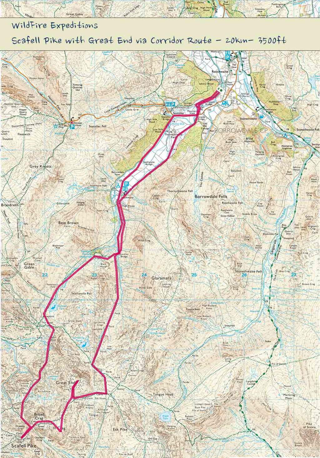
This section provides a detailed, segment-by-segment Corridor Route map Scafell Pike description to guide you from the valley floor to the summit. The route is best tackled in clear weather by those with good mountain fitness and navigation skills.
Starting Point: Seathwaite in Borrowdale
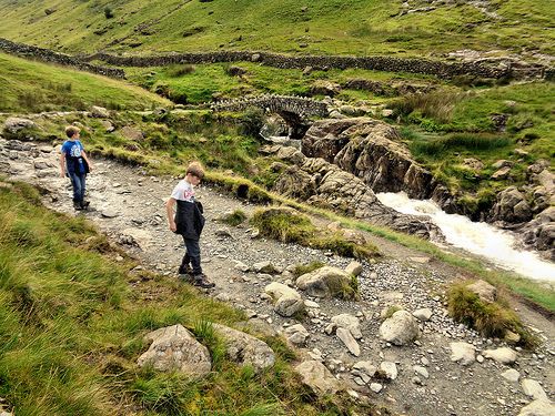
Your journey begins at Seathwaite, a small hamlet at the end of the Borrowdale road, famous for being one of the wettest inhabited places in England [1]. After parking (see parking section below), the walk starts with a gentle and pleasant stroll through Seathwaite Farm and along the banks of the River Derwent. This initial flat mile is a perfect warm-up, leading you to the iconic Stockley Bridge. After crossing the stone bridge, the path begins its first proper ascent, climbing steadily alongside Styhead Gill towards the mountain pass of Sty Head.
Joining the Corridor Route
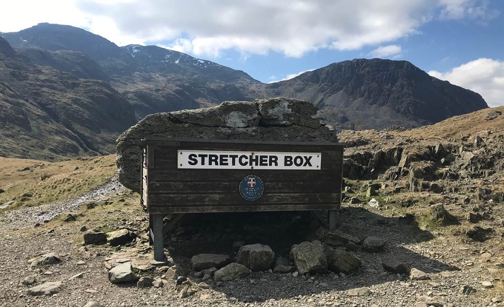
As you reach the high pass of Sty Head, you’ll arrive at Styhead Tarn, a beautiful mountain lake that makes for a great first rest stop. Here you will also find the iconic red Mountain Rescue Stretcher Box, a vital piece of equipment for the volunteer rescue teams. From the stretcher box, instead of continuing on the main path towards Esk Hause, you will turn left (south) and then quickly right to find the start of the Corridor Route. The path cuts across the western slopes of Great End, becoming a narrower, winding trail that immediately gives a sense of adventure and remoteness.
Navigating Key Sections
This is the heart of the route, where careful navigation and sure-footedness are essential. The path traverses high above the valley, presenting several challenges and spectacular views.
- The ‘Bad Step’ and Skew Gill: Early on, the route crosses Skew Gill, notable for its red-stained rock. Shortly after, you will encounter what is often referred to as the ‘Bad Step’. This is a short but tricky section of rock that requires a downward scramble (or an upward one on the return). While not technically difficult for experienced scramblers (Grade 1), it requires the use of hands and can be intimidating for the uninitiated, especially in wet conditions. Always maintain three points of contact and take your time.
- Skirting Piers Gill: The path continues, eventually running high above the dramatic ravine of Piers Gill. This is the most critical part of the route for safety. Piers Gill is a deep, treacherous canyon filled with waterfalls, and it is the scene of many mountain rescue callouts and tragedies. You must not descend into the gill. The path stays well above it, crossing at its very head before continuing towards Lingmell Col. The views into the gill are impressive, but the path is narrow and exposed in places, demanding your full concentration.
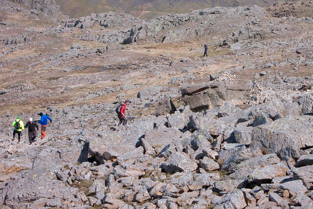
- Stream Crossings and Boulders: The route involves crossing several smaller streams (becks) and navigating sections of boulders and scree. The path can be indistinct at times, eroded by weather and footfall, making a map and compass indispensable, especially if mist descends.
The Final Ascent to Scafell Pike Summit
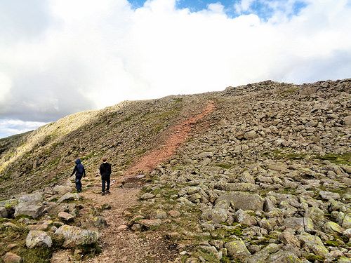
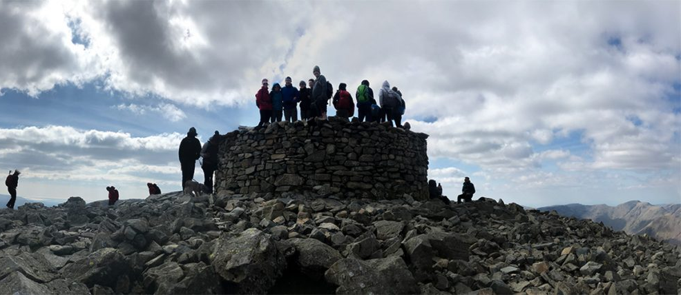
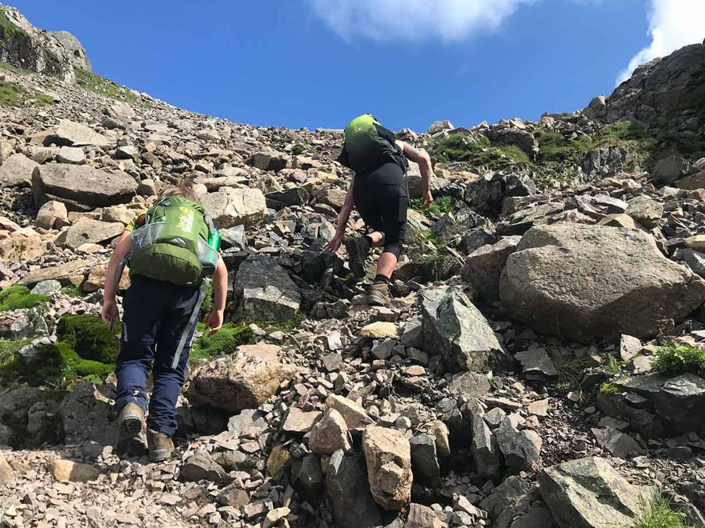
After successfully navigating the traverse, the Corridor Route climbs to meet the broad saddle of Lingmell Col. Here, you join the main path coming up from Wasdale Head, which is often much busier. Turning left, you face the final push to the summit. This last section is a relentless and steep climb over a chaotic sea of boulders and loose scree. A series of large cairns mark the way, but they can be difficult to spot in poor visibility. The effort is rewarded when you finally step onto the vast, rocky summit plateau. At the top, you’ll find the large circular summit cairn and trig point, marking the highest point in all of England at 978 metres. On a clear day, the 360-degree panorama is simply unparalleled, stretching from the Isle of Man to the mountains of Wales and Scotland.
Planning Your Corridor Route Ascent: Key Considerations
Success on the Corridor Route is defined by thorough preparation. This is a serious mountain walk, and underestimating it can lead to trouble. As the Wasdale Mountain Rescue Team advises, proper planning is key to a safe and enjoyable day.
Corridor Route Scafell Pike Parking: Where to Start
The primary starting point for this route is Seathwaite in Borrowdale (Postcode: CA12 5XJ).
- Seathwaite Farm Parking: There is a pay-and-display car park at Seathwaite Farm. The cost is typically around £5 for the day.
- Roadside Parking: Limited free parking is available along the roadside leading to the farm.
- Arrive Early: This is crucial. Seathwaite is a legendary starting point for many classic hikes, including ascents of Great Gable and Scafell Pike. Car parks and roadside spaces fill up extremely early, especially on weekends and during peak season (June-August). Aim to arrive before 9 am to secure a spot.
- Public Transport: While a car is most convenient, you can get to the area via bus. The 78 bus service runs from Keswick into the Borrowdale valley, stopping at Seatoller, which is a short walk from Seathwaite.
Scafell Pike Corridor Route Difficulty: How Challenging Is It?
The Scafell Pike Corridor Route difficulty is consistently rated as challenging or strenuous. It is not a suitable walk for beginners or families with young children.
- What makes it difficult? The challenge comes from a combination of factors: significant length and ascent, sustained sections of rough, rocky, and uneven terrain, the need for confident navigation, and short sections of Grade 1 scrambling with some exposure.
- Fitness Required: A good level of mountain fitness is essential. You should be comfortable walking for 6-8 hours with over 1,000 metres of ascent on rough ground.
- Comparison to other routes: It is longer and more technically demanding than the direct route from Wasdale Head but is generally considered more scenic. It is a significant step up from easier fells like Catbells or even moderate peaks like The Old Man of Coniston.
Scafell Pike Corridor Route Time: How Long Will It Take?
The average Scafell Pike Corridor Route time for a round trip from Seathwaite is between 6 and 8 hours.
- Distance: The route is approximately 9.5-10 miles (15-16 km) as a circular walk.
- Elevation Gain: Expect a total ascent of around 1,000-1,100 metres (approx. 3,500 ft).
- Factors to Consider: This time is an estimate. Your actual time will depend on your group’s fitness, pace, the number of breaks you take, and, most importantly, the weather conditions. Poor visibility or wet, slippery rocks will slow you down considerably. Always start early to allow plenty of daylight and a buffer for unexpected delays.
Is Corridor Route Dangerous Scafell Pike? Addressing Safety Concerns
This is a critical question. For a well-prepared, experienced hiker in good conditions, the Corridor Route is a thrilling and safe adventure. However, it has objective dangers and can be very dangerous if underestimated or attempted in adverse conditions.
Piers Gill Hazard: The single greatest danger is accidentally descending into Piers Gill. This is a deep, inescapable canyon. Mountain Rescue teams are frequently called to incidents here, some of which have been fatal. The path crosses the *head* of the gill; you must not follow the stream down into the ravine itself. New signage and stone markers are being planned to make the correct path clearer at this key junction.
- Key Risks:
- Navigation Errors: The path can be indistinct in places, and the summit plateau is notoriously confusing in mist. Getting lost is a primary cause of rescue callouts [1, 24].
- Slips and Falls: The terrain is rocky, often wet, and slippery. The ‘Bad Step’ scramble and the narrow path above Piers Gill require particular care.
- Weather: The weather on Scafell Pike is notoriously fickle. Sun in the valley can be gale-force winds, freezing temperatures, and torrential rain on the summit. Temperatures can be 10°C colder at the top, with significant wind chill.
- How to Mitigate Risks:
- Check the Forecast: Always check a mountain-specific forecast like the Met Office Mountain Forecast or MWIS before you go.
- Avoid in Bad Weather: Do not attempt this route in high winds, heavy rain, or winter conditions (ice and snow) unless you are an experienced winter mountaineer with an ice axe, crampons, and the skills to use them.
- Know Your Limits: Be honest about your experience and fitness. The mountain will be there another day.
Essential Gear and What to Pack
Packing the right gear is a matter of safety, not just comfort. Never underestimate the mountain.
- Footwear: Sturdy, waterproof hiking boots with good ankle support are essential for the rocky and wet terrain.
- Waterproofs: A reliable waterproof jacket and waterproof trousers are non-negotiable, even in summer.
- Layers: Pack multiple warm layers (fleece, insulated jacket), plus a hat and gloves. Avoid cotton.
- Navigation: A physical Corridor Route map Scafell Pike (OS Explorer OL6) and a compass are vital. You must know how to use them.
- Technology: A GPS device or a phone with a mapping app (and offline maps downloaded) is an excellent backup, but bring a power bank as batteries die in the cold.
- Safety Kit: A headtorch (even on a day walk), a whistle (six blasts for emergency), a first-aid kit, and an emergency bivvy bag or survival blanket.
- Food and Water: Carry plenty of high-energy food and at least 2 litres of water.
Navigation on the Corridor Route
Do not rely solely on technology. A map and compass are your most reliable tools. The path is not always a clear, signposted trail like you might find in other countries; it’s a mountain path that requires active navigation. In mist, visibility can drop to a few metres, making it incredibly easy to take a wrong turn, especially on the summit plateau and around the head of Piers Gill. Practice your navigation skills on easier Lake District day hikes before tackling this route.
Beyond the Corridor: Scafell Pike Alternative Routes & Descent Options
While this is a Scafell Pike Corridor Route Guide, it’s useful to know the other main options for ascent or descent.
Scafell Pike Alternative Routes
- Wasdale Head (The “Tourist Route”): The shortest and most direct route, but also the steepest. It’s a relentless, often crowded slog but is the most straightforward ascent, taking 4-6 hours for a round trip.
- Great Langdale: The longest of the main routes at around 12 miles (19km). A physically demanding full-day expedition offering varied terrain and incredible vistas, starting from the Old Dungeon Ghyll hotel.
- Eskdale: A long and strenuous route (approx. 11 miles / 17.5km) that offers a true sense of wildness and remoteness. It’s significantly harder to navigate and is best for experienced walkers seeking solitude.
Descending Safely from the Summit
Your day is only half done when you reach the summit. The descent requires just as much concentration, especially with tired legs [2].
- Return via the Corridor Route: The most straightforward option is to retrace your steps. This has the advantage of familiarity, but be aware that the ‘Bad Step’ is now a scramble up, which some find easier and others harder.
- Descend via Esk Hause: A popular circular option is to descend from the summit towards Broad Crag and Esk Hause. From Esk Hause, a clear path follows Grains Gill all the way back down to Stockley Bridge, rejoining your outward path. Many find this descent easier on the knees than the rocky Corridor Route.
Conclusion
The Scafell Pike Corridor Route is, without doubt, one of the finest mountain days in England. It encapsulates the very essence of Lake District hiking: a challenging journey through breathtakingly rugged and beautiful scenery that culminates on the nation’s highest point. It demands respect, fitness, and careful preparation, but the rewards are immense. From the first steps at Seathwaite to the final, triumphant moment on the summit cairn, it is an unforgettable adventure.
By using this Scafell Pike Corridor Route Guide, you can embark on this iconic hike with the confidence and knowledge needed for a safe and memorable experience. Pack correctly, check the weather, know your route, and prepare to be amazed by the raw beauty of this magnificent mountain. For those who love a thrilling mountain day, it’s also worth exploring our Helvellyn via Striding Edge Guide for another of the Lake District’s most famous challenges.
Now, it’s time to plan your adventure. Stand atop England’s highest peak, having earned it via this magnificent route, and create a memory that will last a lifetime.
