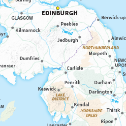
Complete Planning & Itinerary
The Pennine Way is a remarkable 431 km trek that winds its way along the rugged spine of England, traversing through three stunning National Parks and presenting hikers with both challenge and beauty. This 2025 guide breaks the trail into 20 manageable stages, with daily distances ranging from 11 to 32 km, complete with detailed OS Maps and elevation profiles to help you plan your adventure.
When setting out, it’s vital to book your accommodations well in advance, particularly during the busy peak season from May to September. The weather can be notoriously unpredictable, so be prepared for everything from drizzly rain to brisk winds, especially when navigating the exposed moorlands and steep valleys. Don’t forget your waterproof gaiters—you’ll thank yourself when trudging through the inevitable puddles!
In addition to your standard hiking gear, consider packing a good-quality torch, as evening descents can come around quicker than expected. If you’re heading into the Scottish sections, be mindful of pesky midges, particularly in the warmer months; a reliable insect repellent can make all the difference.
As you embark on your journey, remember the importance of trail etiquette and the Countryside Code. Stay on the designated paths to protect the local flora and fauna, and always be respectful of livestock and other hikers. If you’re lucky enough to spot a bothy along the way, it’s a wonderful opportunity to rest and perhaps share stories with fellow adventurers.
With the right training regimens and strategic planning, you can truly elevate your Pennine Way experience. Embrace the adventure, respect the land, and enjoy the breathtaking scenery that awaits!
Key Takeaways
- The 2025 Cicerone guide meticulously breaks down the 431-kilometre Pennine Way into 20 manageable stages, traversing three stunning national parks.
- The prime hiking season runs from mid-May to September, with May and September often providing delightful weather and fewer fellow walkers on the trail.
- It’s wise to book your accommodation in advance at key waypoints such as Edale, Malham, and Kirk Yetholm, particularly during the busy summer months when demand is high.
- Essential gear for this trek includes waterproof gaiters to navigate the notorious boggy stretches and reliable navigation tools, as well as OS Maps, to ensure you’re prepared for the exposed moorlands and unpredictable weather.
- Elevation changes are quite pronounced: the northern sections rise from 200 to 893 metres, the central stretch between 150 and 700 metres, and the southern parts range from 100 to 636 metres. Proper training is essential to tackle these varied terrains effectively.
- Remember to adhere to the Countryside Code while on your journey—stick to paths, respect wildlife, and take all litter home. It’s also courteous to greet fellow walkers and give way to those ascending when on steep paths. Be aware of the UK weather challenges, including sudden rain showers, strong winds, and pesky midges in Scotland, especially during the summer months. Pack accordingly to ensure a safe and enjoyable adventure!
The Pennine Way Guide 2025 requires meticulous attention to detail when it comes to optimizing its metadata elements for our fellow British hikers. Incorporating keywords such as “west highland way essentials” will enhance visibility for those seeking comprehensive hiking information. Furthermore, crafting clear and engaging descriptions will improve the user experience and foster a stronger connection with the hiking community. Regular updates to the metadata will ensure relevance and accuracy as trail conditions and recommendations evolve.
In crafting your SEO title, ensure you include the focus keyword “Pennine Way Guide 2025” along with essential terms like “itinerary” and “route planning” to enhance visibility among those seeking adventure.
Your meta description should succinctly showcase the guide’s standout features, such as the 20-stage route descriptions, the handy Pennine Way map booklet featuring 1:25,000 OS Maps, and comprehensive listings of accommodation options ranging from cosy B&Bs to rustic bothies.
For the URL slug, keep it concise yet engaging—”pennine-way-guide-2025″ is a perfect fit.
Categorizing this content under “Hiking Guides” or “UK Long-Distance Trails” ensures that it reaches the right audience within our community of walkers.
The custom outline should reflect the logical flow of the guide: starting with an engaging introduction, then a thorough route overview, followed by detailed breakdowns of each stage, and concluding with essential planning resources.
Be sure to include relevant background information about the fifth edition’s publisher, Cicerone, along with its dimensions of 177mm x 118mm, weight of 460g, and a price point of £17.95.
This information provides prospective buyers with the complete context they need to make an informed decision.
As you prepare for your hike along the Pennine Way, remember to pack appropriately for the UK’s unpredictable weather—be it rain, gusty winds, or pesky midges in Scotland.
And as always, adhere to the Countryside Code: respect the local wildlife, keep to marked paths, and leave no trace behind.
Happy hiking!
Pennine Way’s Ancient Backbone
Moving beyond the metadata, let’s delve into the geographical and historical significance that lies at the heart of your upcoming adventure on the Pennine Way.
Stretching an impressive 431 km (268 miles) along England’s mountainous spine, the Pennine Way serves as a natural east-west divide. This iconic trail, established in 1965 as the first National Trail in England, begins in Edale within the Peak District and concludes at Kirk Yetholm near the Scottish border.
As you embark on this journey, you’ll traverse three distinct national parks—Peak District, Yorkshire Dales, and Northumberland—each boasting its own unique geological features and ecosystems. Expect challenging terrain that includes remote moorlands and steep ascents, so ensure you’re well-prepared with proper gear and plenty of layers, as the weather can be notoriously unpredictable.
Be ready for everything from sudden downpours to brisk winds, and don’t forget your torch for those early morning starts or late evenings.
As you venture northward, you’ll come across fascinating remnants of Britain’s rich history, from ancient stone circles to the impressive engineering of Hadrian’s Wall. These Roman fortifications are just one chapter in the diverse historical tapestry you’ll witness on what’s affectionately known as the “Backbone of England.”
While enjoying the stunning landscapes, remember to adhere to the Countryside Code. Respect wildlife, stick to the paths, and take your litter home. If you’re fortunate enough to encounter a bothy, consider it a welcome shelter from the elements, but always follow the etiquette of leaving it as you found it.
With the right mindset and preparation, your trek along the Pennine Way promises to be an unforgettable journey through both nature and history. Happy hiking!
England’s Mountainous Spine
England’s Mountainous Spine: A Guide for the British Hiker
Towering majestically over the surrounding landscapes, England’s mountainous spine creates a dramatic backdrop for your Pennine Way adventure. This 431-kilometre trek follows the geological backbone of Britain, demanding both physical stamina and navigational acumen. As you traverse this ancient route, you’ll encounter a variety of terrains across several national parks, each with its own unique charm. Investing in quality hiking boots will ensure comfort and protection throughout your journey across diverse and challenging terrains.
| Section | Elevation Range | Key Features |
|---|---|---|
| Peak District | 91-636m | Kinder Scout plateau, gritstone edges |
| Yorkshire Dales | 61-736m | Malham Cove, limestone formations |
| Northumberland | 76-893m | Hadrian’s Wall, Cross Fell summit |
This trail commands respect, even from seasoned walkers. Split into 20 manageable stages, you can expect to cover between 11-32 km each day, depending on the topography and weather conditions. The UK is notorious for its unpredictable weather, especially in higher elevations; be prepared for sudden rain showers, fierce winds, and even the occasional midge (not a concern in England, but something to keep in mind if you venture into Scotland).
Before you set off, ensure you have the proper OS Maps, and don’t forget your compass. Some hikers prefer lightweight trail runners over traditional boots for better agility on varied terrain. A reliable torch is essential for those early starts or late finishes, while sturdy footwear will keep your feet dry and comfortable. Remember to adhere to the Countryside Code: respect the wildlife, keep to paths to protect the landscape, and leave no trace of your visit.
This challenging yet rewarding route unveils the wild upland character of England with each ascent. Embrace the adventure, but always be mindful of your surroundings and fellow walkers; a smile and a friendly nod go a long way in the great outdoors. Happy hiking!
Prime Hiking: May-September
When planning your Pennine Way expedition, aim for mid-May through September for the best conditions on England’s iconic long-distance footpath. This prime hiking window boasts extended daylight hours, allowing you to cover substantial distances along the 430-km route.
Weather during this period is generally stable, but do prepare for the unpredictable nature of British weather—be it glorious sunshine one moment or sudden downpours the next. Ensure your gear includes layerable, quick-drying clothing, and a dependable waterproof jacket, as well as a good pair of walking boots to handle both muddy trails and rocky paths. Don’t forget to pack quality waterproof trousers to keep your lower body dry during unexpected rain showers. Invest in a quality shell jacket that offers reliable protection while maintaining breathability during strenuous hiking sections.
Bear in mind that summer attracts a higher footfall, especially in popular spots like Malham Cove and the Yorkshire Dales. This increased traffic can impact accommodation availability, so it’s wise to book your lodgings well in advance—particularly in more remote areas where options may be limited.
The shoulder months of May and September offer a strategic advantage—typically delivering decent weather while allowing you to sidestep the peak-season crowds. This makes them particularly appealing to seasoned hikers in search of a bit of solitude without compromising on trail conditions.
As you venture out, remember to follow the Countryside Code: respect the land, keep to paths, and leave no trace. If you’re camping, ensure you have a suitable bothy or campsite in mind, and always carry a torch for those unexpected late finishes.
And if you’re heading up to Scotland, don’t forget your insect repellent to ward off those pesky midges! Happy hiking!
Challenging Topography Chart
To gear up for the Pennine Way’s demanding terrain, it’s crucial to get acquainted with our detailed Challenging Topography Chart, which meticulously outlines the elevation profile of this 265-mile route.
The chart showcases significant elevation changes throughout the 20-stage journey, notably the daunting ascent of Cross Fell at 893 metres—the highest point along the trail. Right from the outset after leaving Edale, you’ll be faced with tricky bogs and exposed moorlands, so be sure to have your technical footwork and appropriate equipment at the ready.
| Section | Elevation Range | Primary Challenges |
|---|---|---|
| Northern | 200-893m | Exposed plateaus, challenging Cross Fell climb |
| Central | 150-700m | Extensive peat bogs, limited waymarking |
| Southern | 100-636m | Steep valleys, uneven terrain from Edale |
As you navigate through the more remote sections, be mindful that visibility can drop quickly, especially in typical British weather with rain, strong winds, and the occasional midges if you’re heading into Scotland. It’s essential to plan your daily distances carefully, which can range from 11 to 32 km, to manage your energy effectively on the rugged terrain. Our chart highlights prime rest points and alternative routes to take when conditions turn against you.
Remember to follow the Countryside Code while out on the trail: stick to paths, respect wildlife, and ensure you leave no trace behind. If you come across a bothy, it’s a welcome opportunity to rest and share stories with fellow hikers. Happy trekking!
Training for High Moorlands
To tackle the high moorland sections of the Pennine Way, a systematic training regimen is essential for building both physical endurance and technical skills. Aim for weekly long-distance walks of 24-32 km across diverse terrain that closely mirrors the trail’s rugged conditions.
Elevation training is a priority, particularly to prepare for the steep ascents around Edale and Cross Fell. Incorporate stair climbing and hill running into your routine to strengthen your calves and thighs—muscles that will support you through the toughest stretches of the route.
It’s crucial to train with your fully loaded rucksack to get your body accustomed to the weight you’ll be carrying over boggy and uneven ground.
Don’t overlook the importance of navigation practice, especially in poor visibility. The Pennine Way’s markers can easily vanish in mist, so honing your map reading skills is vital. Consider carrying a GPS for hiking to supplement traditional navigation methods when visibility becomes challenging. Set aside several training sessions in challenging weather—think rain and blustery winds—to develop this critical competency before facing the notorious moorland conditions.
As you prepare, remember to adhere to British trail etiquette and the Countryside Code: leave no trace, respect wildlife, and always keep to paths to protect the landscape.
And when you’re out and about, pack a sturdy torch, as the UK weather can change quickly, and you might find yourself needing it after a long day on the hills. Happy hiking!
Waterproof Gaiters Are Essential
Waterproof gaiters are an absolute must-have for your Pennine Way kit, particularly given the infamous bogs that are a hallmark of this legendary route. They serve as a vital barrier between your boots and the relentless dampness that typifies much of the trail.
When you’re on the lookout for waterproof gaiters, be sure to choose breathable materials that allow moisture to escape while keeping your feet dry.
Well-fitting waterproof gaiters provide four crucial benefits:
- Protection from immersion – They help keep your feet dry during necessary river crossings, which can crop up unexpectedly.
- Defence against saturation – Gaiters act as a barrier against soaking wet vegetation and the driving rain that the UK is all too familiar with.
- Extended boot longevity – By reducing wear and tear from abrasions and moisture, they help preserve your expensive hiking boots for longer.
- Enhanced warmth retention – They add an extra layer of insulation, which can be a lifesaver in the exposed moorland conditions where temperatures can drop unexpectedly.
You’ll find that investing in good gaiters pays off especially in the Black Hill and Cross Fell sections, where boggy conditions can easily exceed ankle depth any time of year.
Remember to always adhere to the Countryside Code: respect the environment, leave no trace, and be considerate of other walkers.
And if you’re venturing into the wilds of Scotland, be mindful of the midges that can be a nuisance during the warmer months! Happy hiking!
When selecting the right pair for your trek, consider hiking gaiters that are specifically designed for the challenging terrain and weather conditions of the Pennine Way.
Budget-Friendly B&B Bookings
As you prepare for your Pennine Way adventure, securing budget-friendly B&B accommodations is an essential step that requires a bit of foresight. The more remote stretches of the trail offer limited options for places to stay, making it wise to book ahead—especially during the peak season from May to September when many fellow walkers are out enjoying the trails.
| Location | Booking Method | Key Amenities |
|---|---|---|
| Edale | Central Office | Breakfast, Wi-Fi |
| Malham | Online Platform | Laundry, Packed Lunch |
| Bellingham | Direct Contact | Drying Room, Transport |
| Kirk Yetholm | Trail Website | Evening Meals, Luggage Transfer |
| Middleton | Accommodation App | Early Breakfast, Boot Room |
The official Pennine Way website features downloadable accommodation listings for each section of the trail, facilitating efficient itinerary planning. Most B&Bs cater to long-distance walkers by providing essential services, such as hearty breakfasts to fuel your day and laundry facilities to keep your gear fresh after a long trek. Beyond the practicalities, B&Bs offer the chance for engaging interactions with your hosts and fellow trekkers, adding to the camaraderie of your journey while keeping costs manageable.
Boggy Section Resupply Strategy
Navigating the Pennine Way’s infamous boggy sections necessitates a well-thought-out resupply strategy, particularly when your booked B&Bs are spaced apart by significant stretches of challenging terrain.
It’s vital to plan your provisions with care, focusing on key resupply hubs like Hebden Bridge and Gargrave, where you can restock efficiently.
Key components of your boggy section resupply plan:
- Portable Water Filtration System: A must-have when traversing the contaminated bog areas, as water sources can be dubious at best. Ensure your system is lightweight and easy to use.
- Strategic Rest Days: Schedule breaks in Malham or Horton-in-Ribblesdale to top up your supplies before tackling the more demanding stretches of the trail. These quaint villages offer a welcome respite as well.
- Stock Up: When you set off from Edale, carry enough high-calorie, lightweight provisions for 2-3 days, particularly as the initial sections are notorious for their bogginess. Look for energy-dense snacks like nuts, dried fruit, and quality bars.
- Inventory of Shops: Keep a detailed list of available shops along your route, including their operating hours. This will help you make the most of your resupply opportunities and avoid any nasty surprises.
The early stages from Edale present particular challenges, especially with unpredictable UK weather—be prepared for rain and wind, and if you’re heading north to Scotland, don’t forget about those pesky midges in the summer months.
Remember to adhere to British trail etiquette and the Countryside Code: respect the land, leave no trace, and be courteous to fellow walkers.
With careful planning and the right mindset, you’ll tackle the Pennine Way with confidence. Happy hiking!
Bog Survival Tactics
Successfully navigating the notorious peat bogs along the Pennine Way demands a blend of skill, the right equipment, and a sound strategy to ensure your hike remains both enjoyable and safe.
Your bog survival tactics should kick off with investing in high-quality waterproof boots that provide solid ankle support and effectively keep the moisture at bay. Look for boots that can withstand the typical British weather—think relentless rain and muddy conditions.
Always make use of trekking poles when tackling boggy stretches; they’re invaluable for maintaining your balance and testing the firmness of the ground before putting your full weight down. As you navigate these tricky sections, stick to the marked paths. This not only adheres to the Countryside Code but also helps preserve the delicate ecosystem of the bogs.
When planning your route, be conservative with your timing—allocate extra hours for bog crossings in your itinerary. The squelchy terrain can significantly slow your pace, so it’s wise to account for this.
Remember, it’s important to respect fellow hikers by maintaining a reasonable distance and only overtaking where it’s safe to do so.
Lastly, don’t forget to pack spare socks and be prepared to change them at the first sign of dampness. This simple tactic can ward off blisters and keep your spirits high during those challenging stretches.
And if you’re venturing in Scotland during the summer months, keep an eye out for midges; a good midge repellent can be a game changer.
With these tips in mind, you’re all set for an adventure through the UK’s beautiful yet challenging landscapes. Happy hiking! Explore the diverse terrain ranging from rugged mountains to tranquil lakes, each step revealing the breathtaking beauty of nature. Be sure to check out the UK national parks hiking trails, which offer everything from leisurely walks to demanding treks. With the right preparation, your adventure will be memorable and fulfilling.
Train Connections From Major Cities
Once you’ve honed your skills in bog survival, the next step is to make your way to the Pennine Way trail. Thankfully, the robust train connections across the UK make reaching both trailheads a doddle. Edale, the southern end of the Pennine Way, is conveniently served by direct rail services from Manchester, Sheffield, and Derby, with journey times ranging from 30 to 60 minutes depending on your starting point.
If you’re setting off from London, be prepared for a journey of around 3 hours, which involves a change at Sheffield. For those heading from Leeds, you’re in luck with direct trains getting you to Edale in roughly 90 minutes—perfect for our northern hikers. Adventurers departing from Birmingham will need to switch at either Derby or Sheffield, with total travel times sitting between 2 to 3 hours.
For your return leg, Kirk Yetholm‘s northern terminus connects to the rail network through Berwick-upon-Tweed. From there, local bus services will help you bridge the gap between the station and the trail. It’s wise to book your tickets in advance to snag the best departure times and fares, especially during the peak hiking seasons when the trails are bustling.
As you prepare for your hike, remember to check the weather forecast—UK weather can be notoriously unpredictable, so pack your waterproofs and be ready for everything from rain to wind.
And if you’re venturing into the Scottish sections, don’t forget your insect repellent to fend off those pesky midges!
While you’re out enjoying the stunning scenery, please respect the Countryside Code: stick to marked paths, take your litter home, and be considerate of wildlife and fellow hikers.
With the right preparation and a spirit of adventure, you’re all set for an unforgettable experience on the Pennine Way!
Daily Costs & Spending Analysis
Tackling the Pennine Way requires a keen understanding of your finances, especially given the unpredictable nature of UK weather. Daily expenditures can vary significantly, typically ranging from £30 to £60. Your budget will largely depend on your accommodation choice, whether you opt for budget camping under the stars or a more comfortable B&B experience.
| Expense Category | Budget Option | Premium Option |
|---|---|---|
| Accommodation | £15 (camping, often in a bothy) | £50+ (B&Bs) |
| Food | £10 (self-catering) | £15 (pubs/cafes) |
| Miscellaneous | £5 (minimal) | £20 (comfort items) |
When working out your daily costs, don’t forget to account for the occasional taxi service to reach those more remote sections of the trail, which could set you back an additional £10-£30. It’s also wise to prepare a contingency fund for unexpected expenses, such as replacing gear or dealing with weather-related detours—after all, a sudden downpour or a brisk wind can alter your plans.
Make sure your total budget comfortably accommodates both your anticipated daily expenses and any buffer amounts for unforeseen circumstances. This way, you can fully enjoy your journey along the Pennine Way without the worry of financial strain dampening your adventure.
Remember to adhere to the Countryside Code as you navigate the trail—respect the land, leave no trace, and always be considerate of local wildlife and fellow hikers. With a bit of preparation and a flexible mindset, you’ll be well-equipped to tackle the challenges and joys of this incredible route. Happy hiking!
Hazardous Bog Crossings
Navigating the Boggy Crossings of the Pennine Way****
Tackling the infamous bog sections of the Pennine Way requires not only technical prowess but also a resilient mindset, especially on the initial leg from Edale. Here, extensive peat bogs can turn solid ground into perilous terrain, so you’ll want to keep your wits about you. Look out for misleading paths that often lead to deep mud or water hazards instead of safe passage.
The most treacherous bog crossings typically occur in the high, exposed moorlands where visibility can quickly deteriorate in misty conditions. Your navigation skills will be crucial, as the wet peat can obscure established trails, making route finding quite the challenge.
It’s wise to don a sturdy pair of waterproof boots with a good grip; accept that keeping your feet dry will be a rare luxury on this hike.
Always assess conditions honestly and be aware of your own limits. When approaching particularly tricky sections, use your trekking poles to test the ground stability before committing your weight. Trekking poles provide essential stability and balance when crossing uneven bog terrain. It’s also a good idea to have alternative routes in mind should conditions prove impassable.
Keep in mind the unpredictable British weather—be prepared for rain, wind, and, if you’re venturing into Scotland, the dreaded midges, especially in the warmer months. A reliable OS Map and a charged torch are essential for safe navigation.
Remember the Countryside Code: respect the landscape, consider other walkers, and leave no trace behind. Be courteous, especially on narrow paths, and step aside to let others pass.
Enjoy the adventure, but stay safe out there!
Alfred Wainwright’s Pioneering Route
While bogs can pose quite the challenge along the Pennine Way, they’re merely one facet of this extraordinary trail’s character—a character profoundly shaped by the pioneering work of Alfred Wainwright.
When you lace up your walking boots and embark on the Pennine Way today, you’re treading a path first mapped out by Wainwright in 1965. This iconic trail has since become one of Britain’s most revered long-distance routes. His meticulously crafted guidebooks transformed the way we navigate this demanding terrain, providing detailed descriptions and illustrations that are still indispensable to walkers, even as we step into 2025.
Wainwright’s impact goes far beyond navigation. His passionate portrayal of the trail’s natural beauty—from the rugged contours of the Peak District to the expansive vistas of the Scottish Borders—has cemented the Pennine Way as a quintessential British walking experience. His work encapsulates the landscape’s essence in exquisite detail, inviting hikers to appreciate the wild and varied scenery.
As you prepare for your adventure, keep in mind that you’re following in the footsteps of countless hikers inspired by Wainwright’s pioneering spirit and commitment to this magnificent trail. Adopting base weight reduction principles can make your journey through these challenging landscapes significantly more enjoyable.
Be sure to pack your essentials, including a good-quality OS Map, a reliable torch for those unexpected evening descents, and your waterproof gear—because let’s face it, UK weather can be notoriously unpredictable.
Keep an eye out for those pesky midges, especially in the Scottish sections, and always remember to adhere to the Countryside Code. Respect the land, leave no trace, and share the trail with fellow walkers.
Whether you’re stopping for a breather at a bothy or simply soaking in the views, embrace the journey and the camaraderie of fellow adventurers. Considering the demanding nature of this long-distance trail, investing in an ultralight backpack can significantly reduce fatigue and enhance your overall experience. Happy hiking!
Top 15 Pennine Way FAQs
When planning your hike on the Pennine Way, it’s vital to choose your timing wisely. Between May and September is generally regarded as the best window for tackling this iconic trail, as it offers a good balance between accessibility and the often capricious British weather.
Be prepared for anything from sunshine to sudden downpours, and don’t forget the wind, which can be particularly fierce in exposed areas.
You’ll want to ensure you have the right gear for the varied terrain and unpredictable conditions. Essential items include reliable navigation tools—OS Maps are a must—waterproof layers to shield against the rain, and sturdy footwear that can handle both muddy paths and rocky stretches.
A good pair of walking boots can make all the difference on the Pennine Way, especially when dealing with its ups and downs.
Accommodation planning is another crucial aspect of your hike. It’s wise to book your spots in advance, whether you’re aiming for hostels, B&Bs, or campsites.
This is particularly important in the more remote sections of the trail, where options can be few and far between during the peak season.
Lastly, remember to respect the Countryside Code while you’re out on the trail. Stick to designated paths, take your litter home, and be mindful of wildlife and livestock.
If you’re hiking in Scotland, keep an eye out for midges in the warmer months—an insect repellent can be a lifesaver!
With these tips in mind, you’re well on your way to enjoying the Pennine Way like a seasoned pro. Happy hiking!
Best Season To Go
The ideal time to tackle the Pennine Way falls between mid-May and September. During this window, you’ll benefit from the longest daylight hours and relatively stable weather, providing a much more enjoyable hiking experience along this challenging National Trail.
While spring and early autumn can still be suitable, be aware that they come with a higher risk of rain and shorter daylight. Summer, though popular, brings its own challenges such as busier paths and the need for extra hydration, particularly on exposed moorland sections where shade is scarce.
Winter attempts are strongly discouraged due to the hazardous conditions, limited daylight hours, and the potential for severe weather, including snow and ice.
As you plan your 16-19 day adventure, consider incorporating rest days at charming spots like Hebden Bridge, Malham, and Horton-in-Ribblesdale. This won’t only enhance your overall experience but also allow for proper recovery during your journey, which spans roughly 430 km (267 miles).
When out on the trail, always remember to follow the Countryside Code: respect the local wildlife, keep to paths to protect crops and wildlife, and leave gates as you found them.
It’s also good practice to carry a trusty OS Map and a reliable torch for navigation, especially during those longer summer evenings when the sun sets later.
And if your journey takes you through Scotland, don’t forget to pack some insect repellent for those pesky midges, particularly in the warmer months!
Happy hiking!
Equipment You’ll Need
Essential Gear for UK Conditions
Preparing for your journey along the Pennine Way requires careful consideration of your equipment. With a distance of 431 km (268 miles) to cover, the right gear can significantly enhance your experience, ensuring both safety and comfort.
After 250+ miles, you’ll appreciate a comfortable Therm-a-Rest NeoAir XLite for recovery sleep
Firstly, navigation is crucial, so be sure to carry an OS Map and a reliable compass. It’s also wise to download GPX files for added peace of mind, particularly in the more remote areas where mobile signal may be patchy.
For the full 268-mile Pennine Way, invest in a quality 40 litre backpack – read our expert reviews
Given the notoriously unpredictable British weather, especially in the exposed moorlands, pack high-quality waterproof clothing and several warm layers. A good waterproof jacket and trousers are essential, as you can often encounter rain and wind, even in summer. Don’t forget your hat and gloves—yes, even in July!
Invest in sturdy hiking boots with solid ankle support, designed to tackle the rugged, often boggy terrain. Consider adding quality hiking insoles to provide extra cushioning and support during your long-distance trek. It’s advisable to steer clear of denim; instead, opt for lightweight, quick-drying materials that allow for ease of movement and comfort on the trail.
An emergency pack is non-negotiable. Ensure it contains a first aid kit, a whistle, and a torch for those unexpected early evenings or low-visibility situations.
Water management is key as well—carry enough supplies and consider a reliable water filtration system, as natural sources can be scarce and may need treating.
For overnight sections, a lightweight backpacking stove is essential for preparing hot meals and beverages to maintain your energy levels throughout the journey.
As you prepare, remember the principles of the Countryside Code. Respect the wildlife, keep to the paths, and ensure you leave no trace of your visit. Following these guidelines not only protects the environment but also enhances the experience for everyone enjoying this incredible trail.
With the right gear and a good dose of British spirit, your Pennine Way adventure can be both rewarding and safe. Happy hiking!
Accommodation Booking Tips
When gearing up for your Pennine Way adventure, sorting out your accommodation is a vital part of the planning process that deserves thoughtful attention. The trail presents a variety of options, from campsites and youth hostels to charming B&Bs and hotels, but do keep in mind that availability can be scarce in those more remote stretches.
Make sure to prioritise your bookings for well-frequented spots like Hebden Bridge, Malham, and Hawes, where you’ll find facilities tailored specifically for walkers. I highly recommend checking out the official Pennine Way website’s accommodation guide, which provides detailed listings with contact details for each section of the trail.
While some seasoned hikers manage to find lodging on the fly without a strict itinerary, it’s wise to book in advance, especially during peak seasons and bank holidays. If you want to lighten your load, consider using specialist companies that offer baggage transfer services alongside accommodation. This way, you can hike with just a daypack, making your 430 km trek a tad more comfortable.
Don’t forget that UK weather can be quite unpredictable, so be prepared for everything from drizzling rain to blustery winds, and for those heading into Scotland, keep an eye out for pesky midges.
Always remember to follow the Countryside Code: respect the land, be considerate of others, and leave no trace of your visit. Happy hiking!
Pack Multi-Terrain Hiking Boots
Selecting the right footwear is arguably the most important decision you’ll make when gearing up for the Pennine Way. Your multi-terrain hiking boots need to tackle the trail’s varied challenges—from muddy paths and rocky ascents to the infamous peat bogs that can ensnare ill-suited footwear.
Opt for waterproof boots equipped with GORE-TEX or similar membranes to keep your feet dry during the inevitable rain and stream crossings typical of UK weather. Good ankle support is a must for the uneven terrain, especially during those longer stretches of 32-40 km where fatigue can increase your risk of injury.
Look for boots with an aggressive tread pattern and durable rubber compounds that will provide traction on slippery limestone and wet moorland alike. When trying on boots, ensure there’s about a thumb’s width of space between your longest toe and the end of the boot, and don’t forget to wear the hiking socks you plan to use on the trail—this will help you find the right fit.
Some hikers prefer lightweight trail running shoes for sections with less technical terrain, as they offer greater flexibility and comfort during extended hikes.
Make sure to break in your boots thoroughly with shorter hikes before you embark on the Pennine Way; properly conditioned footwear is key to preventing the blisters that can cut many hikers’ trips short.
And remember to adhere to the Countryside Code: respect the local wildlife, leave gates as you find them, and take all your litter home with you. Enjoy your adventure, and keep an eye out for midges in Scotland during the warmer months!
Moorland to Mountain Trail
The Pennine Way offers a stunning topographical journey as you transition from the southern moorlands to the northern mountains. This iconic long-distance walking route stretches 426 km (265 miles) along England’s spine, providing a rich tapestry of northern landscapes.
You’ll kick off your adventure in the Peak District, where the distinctive moorlands set the scene. As you make your way into the Yorkshire Dales, the terrain shifts dramatically, showcasing captivating limestone features. Eventually, you’ll face the rugged challenges of Northumberland National Park. The trail is divided into 20 stages, each varying significantly in distance—from 11 km to 32 km daily—and in difficulty, so be prepared for a range of experiences.
Navigation skills are crucial, especially when the mist rolls in over those high, exposed moorlands. Although the trail is marked by acorns, I strongly advise bringing your OS Maps and a good compass, as conditions can change rapidly. Early sections of the route can be notorious for their peat bogs, so ensure you have the right footwear and equipment—waterproof boots and gaiters are a must!
Ideally, plan your hike between mid-May and September for the best conditions, but do be ready for sudden weather changes at any elevation; rain and wind can arrive without warning, and don’t forget those pesky midges, especially in Scotland! For nighttime warmth without adding bulk to your pack, consider an ultralight down bag that offers excellent insulation while minimizing weight.
For overnight comfort during your multi-day trek, invest in a quality sleeping pad that provides both insulation and cushioning from the hard ground. Consider factors such as weight, size, and R-value to ensure the pad meets your specific needs and preferences. Additionally, researching how to select a sleeping pad can guide you in making an informed choice that balances comfort and portability. A well-chosen sleeping pad can greatly enhance your overall trekking experience by providing the necessary support for a restful night’s sleep.
As you navigate the trail, remember to practice good British trail etiquette and adhere to the Countryside Code. Stick to the paths to protect the flora, keep dogs on leads, and take all litter home with you.
If you need to rest, consider using one of the bothies along the way for shelter, but always be respectful of others using these communal spaces. Happy hiking!
Edale to Kirk Yetholm
From your starting point in Edale to your triumphant finish in Kirk Yetholm, you’ll be tackling a formidable 431 km of some of Britain’s most challenging and rewarding terrain. The Pennine Way is traditionally divided into 20 stages, often completed over three weeks with well-placed rest days at charming spots like Hebden Bridge and Malham.
| Section | Distance (km) | Key Challenges |
|---|---|---|
| Peak District | 72 km | Exposed moorlands |
| South Pennines | 82 km | Navigation in fog |
| Yorkshire Dales | 100 km | Limestone terrain |
| North Pennines | 117 km | Remote stretches |
| Cheviots | 60 km | Border crossings |
Prepare yourself for high, exposed moorland that demands robust navigation skills, especially in less than ideal visibility. Daily distances typically range from 11 to 32 km, allowing for a flexible pace based on your experience level. Remember to check the weather forecast regularly, as conditions can change rapidly—be ready for rain, wind, and even midges in the northern stretches!
Plan your accommodation meticulously; it’s wise to book youth hostels, B&Bs, and campsites well in advance, as options can be scarce in the more remote areas of the Pennine Way. Familiarise yourself with the Countryside Code—leave no trace, respect wildlife, and follow the paths to help preserve this beautiful landscape for future generations.
And don’t forget your essential gear for UK conditions! A reliable map (OS Maps are your best bet) and a good-quality torch will keep you on track during those long, dusky evenings. Enjoy your adventure on this iconic trail! Consider researching wild camping locations in the UK to enhance your experience, as finding the perfect spot can add a unique touch to your journey. Be sure to familiarize yourself with local regulations regarding camping, as respecting the environment is crucial. Lastly, pack light but wisely, ensuring you have all the necessities to make the most of your adventure.
May-June: Drier Paths
When planning your Pennine Way adventure, the months of May through June stand out as the prime time to tackle this iconic trail. During this period, you’ll find paths significantly drier as spring rainfall begins to taper off, turning those notoriously muddy stretches into much more manageable terrain.
The stunning landscapes of the Peak District and Yorkshire Dales truly come alive during these months. The vibrant flora paints a breathtaking backdrop for your journey, so be sure to take a moment to soak it all in.
Plus, with the longer daylight hours of late spring and early summer, you’ll have ample time to cover greater distances without feeling rushed.
Opting for a May-June hike brings a tactical advantage as well: the trail conditions strike a lovely balance between accessibility and solitude. You’re likely to encounter fewer fellow walkers compared to the busier July and August months, allowing for a more tranquil experience as you navigate the more challenging sections.
This timing not only enhances the physical experience of the trail but also enriches the overall quality of your Pennine Way expedition.
However, do prepare for the unpredictable British weather. While you’re likely to enjoy some pleasant sunny spells, it’s wise to pack your waterproofs, as rain can come out of nowhere.
A sturdy pair of boots is essential, as the terrain can still be tricky. Don’t forget your torch for those late evenings, and be mindful of the Countryside Code: stick to the paths, respect wildlife, and take all your litter home.
If you’re venturing further north into Scotland, be prepared for midges in the evenings—an insect repellent can be a lifesaver.
Embrace the adventure ahead, and happy hiking!
Stage-By-Stage Elevation Charts
Understanding the elevation changes along the Pennine Way is vital for a successful trek across its 20 stages. Our detailed stage-by-stage elevation charts offer invaluable insights into the varied terrain you’ll encounter, allowing for strategic planning of your daily distances and physical preparation.
| Stage Region | Max Elevation | Elevation Gain | Difficulty |
|---|---|---|---|
| Edale to Crowden | 600m+ | Significant | High |
| Yorkshire Dales | 700m+ | Substantial | Moderate-High |
| North Pennines | 700m+ | Extensive | Challenging |
| Border Region | Varied | Moderate | Medium |
The initial stages from Edale are particularly demanding, with steep ascents that will test your stamina and pacing abilities. As you study these elevation charts, pay special attention to sections that exceed 600 metres; they often lead into more technical terrain, which can slow your progress considerably.
Always be prepared for the unpredictable British weather—rain and wind can strike at any moment, especially in the Pennines. It’s wise to carry a reliable waterproof jacket and a torch for those sudden changes after dusk. If you’re venturing into the North, keep an eye out for midges, particularly in the warmer months.
The detailed elevation data will help you gauge your daily energy expenditure and identify suitable rest points along each segment of your journey. Remember to respect the Countryside Code: stick to designated paths, leave gates as you found them, and take all litter home with you. It’s all part of being a responsible hiker and preserving our beautiful landscapes for future generations. Happy hiking!
Wild Camping Locations Map
The Wild Camping Locations Map serves as a vital resource for those looking to explore the Pennine Way beyond the confines of traditional accommodation options. For British hikers, the Interactive Map available on the official website is particularly useful for pinpointing potential wild camping sites throughout your adventure.
Just a friendly reminder—there are legal considerations to keep in mind; in England, you’ll need to seek permission from landowners before pitching your tent, while in Scotland, the right-to-roam laws allow for wild camping without prior consent.
Water availability can be quite variable along the trail, especially in the more upland sections where sources may be sparse. It’s essential to plan your water collection points carefully, using the indicators on the map to guide you, particularly when venturing into remote areas.
And don’t forget—our beloved UK weather can be unpredictable, so be prepared for sudden downpours or windy conditions, and keep an eye out for those pesky midges in Scotland during the summer months.
When you do choose to camp at designated wild spots, ensure you’re following leave-no-trace principles. The map provides details on waste disposal regulations for each section, so please remember to pack out all rubbish.
Also, it’s wise to verify access rights for each potential site before settling down for the night, as this aligns with the Countryside Code and helps us all enjoy the great outdoors responsibly.
Waterproof Map Case Essential
Essential Gear for UK Conditions: The Waterproof Map Case****
When tackling the Pennine Way, one of the UK’s most iconic long-distance trails, ensuring that your navigational aids remain dry is paramount. With Britain’s famously unpredictable weather—think torrential rain and gusty winds—your waterproof map case becomes an indispensable piece of kit. It acts as the first line of defence against the dampness that could otherwise leave your OS Maps and guidebooks rendered useless.
When choosing your waterproof map case, pay attention to these key features:
- Full Waterproof Sealing: Ensure it has robust closures to keep moisture out, especially during those relentless downpours that are all too common in the hills and moors.
- Transparent Viewing Panels: Look for a case with clear panels on both sides so you can easily read your maps without needing to take them out, which is crucial when the rain is lashing down.
- Durable Yet Lightweight: Opt for a material that can withstand the rigours of the outdoors—abrasion from rocky paths and the occasional brush with brambles—without adding excessive weight to your pack.
- Lanyard Attachment Points: Handy attachment points allow you to secure your map case to your rucksack when you’re not actively navigating, keeping it safe and easily accessible.
The ever-changeable weather conditions on the moors require consistent protection for your navigational tools. Remember, a quality waterproof map case isn’t just an accessory; it’s vital equipment that will ensure you stay oriented, no matter what Mother Nature throws at you during your trek.
As you prepare for your adventure, always keep in mind the Countryside Code: respect the local wildlife, stick to paths to protect the landscape, and leave no trace of your visit.
Happy hiking!
Sherpa-Supported Daily Transfers
While navigating the rugged terrain of the Pennine Way, you’ll discover that sherpa-supported daily transfers are a game-changer for modern hikers. These services transport your luggage between accommodations, allowing you to walk unencumbered and truly soak in the beauty of Britain’s oldest National Trail without the weight of a heavy pack bearing down on you.
Operating along the entire Pennine Way, sherpa transfers cater to various itineraries and paces. You’ll quickly appreciate the difference as you tackle challenging sections without the burden of your gear, enabling you to focus on the stunning landscapes around you rather than the fatigue of managing your equipment.
Just remember to take care of your fellow walkers by sticking to the established paths and keeping noise to a minimum—it’s all part of the great British trail etiquette.
Be sure to secure your sherpa service well ahead of your 2025 adventure, especially during the busier months from May to September. Many providers offer all-inclusive packages that include accommodation arrangements, which can really simplify your planning.
This seamless integration of services not only keeps your gear safe from the unpredictable UK weather—think rain showers, brisk winds, and the ever-present threat of midges in Scotland—but also ensures that you’re hiking at your best throughout your expedition.
As you prepare for your hike, consult your OS Maps for the best routes and pay attention to the Countryside Code. Respect wildlife, keep your dog on a lead, and take your litter home—it’s all part of preserving our beautiful landscapes for future generations.
Happy hiking!
Grocery Stops by Section
Embarking on the Pennine Way‘s 431-kilometre trek demands meticulous planning, especially when it comes to food resupply. The trail weaves through a patchwork of villages and towns, with key grocery stops like Hebden Bridge, Gargrave, and Hawes providing ample opportunity to top up your supplies.
Before you lace up your boots, ensure you’ve plotted these resupply points on your OS Maps. There are stretches that lead you through remote moorlands and rugged hills, where you’ll find no services, so it’s crucial to be prepared.
Take a moment to check the opening hours of shops, particularly in smaller settlements, as their hours can be quite limited. It’s all too easy to misjudge the distance between grocery stops and find yourself short on rations.
Keep in mind that several accommodations along the route offer meal options. Youth hostels and local pubs often provide evening meals or packed lunches, which can lighten your grocery load. This could be particularly beneficial for those sections where the next grocery stop is beyond a day’s hike.
As you navigate the Pennine Way, remember the essence of British trail etiquette and the Countryside Code. Respect the landscape, stick to paths, and leave no trace of your visit behind.
And, of course, be prepared for the unpredictable UK weather—pack your waterproofs and be ready to face both the wind and rain, as well as the infamous midges if you venture into Scotland during the warmer months. Happy hiking!
Stunning Cross Fell Views
Standing tall at 893 metres above sea level, Cross Fell is the grand pinnacle of the Pennine Way and a must-visit for any serious hiker. As you reach the summit, you’ll be greeted with breathtaking panoramic views that can stretch across the Northern Pennines and, on exceptionally clear days, even reach into the Lake District. However, be sure to prepare thoroughly for this leg of your journey; the terrain can be quite demanding, and the weather can change in an instant—typical of our unpredictable British conditions.
The distinctive Cross Fell stone not only adds a geological layer to your hiking experience but also enhances the dramatic scenery that unfolds before you. Many walkers find themselves enveloped in the summit’s famous mist, creating a mystical atmosphere that elevates the hike from a simple trek to a full sensory adventure. This unique environment, along with the technical challenges of the ascent, makes Cross Fell a memorable experience rather than just another viewpoint.
When visibility permits, don’t forget to bring along your quality binoculars or camera to fully capture the expansive views on offer. The elevation provides a fantastic perspective on the surrounding countryside, but do keep an eye on the weather forecast—strong winds and sudden rain showers aren’t uncommon, so a sturdy waterproof jacket and a reliable torch are essential for your pack.
As you navigate this stunning landscape, remember to adhere to the Countryside Code. Stick to the paths, respect livestock and wildlife, and take your litter home with you. If you’re planning to stop for a break, consider using a bothy if one is nearby, or find a sheltered spot to enjoy your packed lunch.
And if you’re hiking in the warmer months, be prepared for pesky midges, particularly in Scotland—an effective insect repellent can be a game changer.
Cross Fell isn’t just a hike; it’s an adventure that combines technical challenge with the beauty of the great British outdoors. Happy hiking!
Physically Testing Moorland Terrain
The physical demands of the Pennine Way‘s moorland terrain shouldn’t be underestimated, particularly during the first leg from Edale. You’ll encounter high, exposed landscapes that will immediately test your endurance and resolve. Be prepared for wet peat bogs that challenge even the most waterproof footwear—wet socks are almost a certainty in certain sections, so consider carrying a spare pair.
The trail’s rugged terrain includes significant elevation changes, with Cross Fell presenting one of the most formidable challenges along the route. At its highest point, you’ll contend with potential high winds and navigation complexities that require experience and the right gear. A sturdy pair of walking poles can be a real asset here.
Daily distances of up to 32 km will demand thorough fitness preparation and a realistic assessment of your capabilities. It’s crucial to understand your limits, and don’t hesitate to take breaks, especially on steep ascents.
Navigation skills become essential when visibility deteriorates, as fog and mist frequently obscure landmarks and trail markers. Always carry OS Maps and a reliable compass, regardless of any technological alternatives you might be tempted to rely on.
As you traverse these stunning landscapes, remember to respect the Countryside Code: stick to paths, avoid disturbing wildlife, and take your litter home with you. If you encounter other walkers, a friendly nod or a quick chat goes a long way in fostering that community spirit we cherish in the outdoors.
And, if you’re heading further north into Scotland, be ready for the notorious midges—bring some repellent and a net if you’re hiking during the warmer months.
Finally, always carry a torch for those unexpected changes in light, and consider packing a bothy bag for emergencies. Happy hiking!
Reliable Shuttles to Trailheads
Accessing the Pennine Way trailheads becomes a doddle with several reliable shuttle services operating along the route. These dependable transport options link major transport hubs to key access points, taking the hassle out of logistics that can often complicate long-distance hikes.
Many local accommodation providers and businesses are more than happy to arrange specialised transport tailored specifically for walkers. These services offer flexible pick-up and drop-off schedules that align with your hiking itinerary, allowing you to focus on enjoying the stunning scenery rather than fussing over transport.
It’s wise to book your shuttle arrangements at least 4-6 weeks in advance, especially during the peak season from mid-May to September, to ensure you secure your preferred times. This kind of forward planning is essential, particularly when demand is high.
As you prepare for your adventure, remember that UK weather can be unpredictable. Be ready for everything from sudden rain showers to brisk winds, and don’t forget your midge repellent if you’re heading to Scotland in summer!
Always adhere to the Countryside Code: respect the environment, keep to the paths, and leave no trace, ensuring that our beautiful landscapes remain pristine for future generations.
Contingency Fund Calculator
Planning your trek along the Pennine Way requires establishing a robust contingency fund, which acts as your financial safety net for any unexpected expenses that may crop up during your journey. It’s wise to set aside around 10-15% of your overall budget specifically for unforeseen costs that could arise on the trail.
| Expense Category | Daily Cost (£) | Contingency Addition (£) |
|---|---|---|
| Accommodation | 20-50 | 3-7.50 |
| Food | 15-30 | 2.25-4.50 |
| Transport | 10-20 | 1.50-3.00 |
| Baggage Transfer | 5-10 | 0.75-1.50 |
| Emergency Gear | Variable | 2-5% of gear value |
To calculate your budget, multiply the daily costs by the number of days you plan to trek. Remember to consider accommodation types—whether you’re staying in hostels, B&Bs, or perhaps even a bothy for a more adventurous experience. Factor in your food expenses, transport to trail access points, and optional services like baggage transfers, which can help lighten your load on those longer stretches.
Be prepared for the unpredictable UK weather, as you may encounter rain, wind, or even pesky midges in Scotland. This makes it all the more important to have a well-stocked contingency fund for any emergency gear you might need along the way.
As you prepare for your hike, keep in mind the Countryside Code and British trail etiquette. Respect wildlife, stick to paths, and leave no trace to ensure that our beautiful landscapes remain pristine for fellow hikers. Happy trekking!
FAQ: Trail Reopening Status
You’ll be pleased to hear that the Pennine Way is fully operational as per our 2025 guide, with no major closures currently affecting the route.
It’s always wise to check the National Trails website for real-time updates, especially for any temporary diversions that could impact your plans; some sections are prone to seasonal maintenance, so do keep an eye on those!
As you prepare for your adventure, rest assured that your accommodation bookings shouldn’t need to change due to trail closures.
However, we recommend confirming availability with your providers, as demand can fluctuate during the walking season.
Remember to pack your trusty torch for those unexpected moments when daylight fades earlier than anticipated, especially in the depths of winter.
And do keep an OS Map handy to navigate the stunning yet sometimes challenging terrain.
As you’re out enjoying the beautiful British countryside, don’t forget the essential trail etiquette and the Countryside Code.
Respect the wildlife, stick to the paths, and always leave gates as you find them.
And if you’re venturing into the Highlands, be prepared for midges—especially in warmer, damp conditions.
A good midge repellent can make all the difference!
Current Reopening Status
The Pennine Way is currently fully operational along its entire 431-kilometre route from Edale to Kirk Yetholm, with no significant closures reported as of October 2023. The trail is accessible through all the National Parks and moorlands it crosses, proudly holding its title as Britain’s oldest National Trail.
As you embark on this iconic journey, you’ll find the path well-maintained, complete with consistent waymarking to guide your way. However, do remain mindful that localized weather events can occasionally lead to temporary diversions—something to keep an eye on. For up-to-date condition reports, particularly for those remote sections that might face seasonal challenges, be sure to check the official Pennine Way website as you plan your trek for 2025.
The best time for hiking the Pennine Way is from mid-May to September, when trail accessibility is at its peak and the weather is generally more favourable for long-distance walking through the rugged Pennines. However, be prepared for the unpredictable British weather—rain and wind can strike at any time, and if you’re heading into the northern stretches, don’t forget to pack your insect repellent to fend off those pesky midges!
As you traverse the trail, remember to embrace the Countryside Code: respect the environment, leave no trace, and ensure you keep to the paths to protect the delicate ecosystems. If you come across any livestock, please take care to walk around them calmly and quietly.
And finally, don’t forget the essentials—an OS Map, a reliable torch, and a good pair of walking boots are must-haves for any UK hiking enthusiast. Enjoy your adventure on one of Britain’s most celebrated trails!
Major Diversion Updates
While the Pennine Way remains fully operational, it’s crucial for all walkers to be aware of several significant diversions in place for the 2025 hiking season. These updates particularly impact sections within the stunning Yorkshire Dales and the breathtaking Northumberland National Parks, primarily due to necessary trail maintenance and environmental conservation measures. These diversions may also affect access to popular spots along the Hadrian’s Wall walking routes, so it’s advisable for hikers to plan their journeys accordingly. With these changes, the natural beauty and historical significance of the surrounding areas can be preserved for future generations. Additionally, walkers should check local resources for real-time updates to ensure a safe and enjoyable experience.
Before you embark on your adventure, make sure to download the latest GPX files and diversion maps from the official Pennine Way website. This site is regularly updated with the latest reopening statuses, providing you with essential technical routing details to navigate through the affected areas safely.
The 2025 guidebook is an invaluable resource, meticulously detailing all major diversion updates and offering alternative routes where necessary. It’s a good idea to cross-reference this information with the website’s latest updates to ensure you’re fully informed of the current trail conditions, as restoration timelines can shift throughout the season. Additionally, the guidebook highlights points of interest along the way, enriching your hiking experience in the stunning landscapes of Snowdonia. For those planning a trip, the snowdonia hiking trails 2025 section offers insights into the most scenic routes and the best times to visit. Always remember to check local advisories, as weather conditions can greatly affect trail accessibility.
As you prepare for your trek, remember the unpredictable nature of British weather—be it rain, wind, or midges in Scotland. Bring a reliable torch for those dusky walks and ensure you have proper waterproof gear. It’s also worth packing a sturdy pair of walking boots, as the terrain can be rugged.
Lastly, don’t forget to adhere to the Countryside Code, respecting both the environment and fellow hikers. Stick to designated paths, take your litter home, and keep dogs on leads to protect wildlife.
With the right preparation and respect for nature, your journey along the Pennine Way will be an unforgettable experience. Happy hiking!
Accommodation Booking Adjustments
Accommodation Booking Adjustments for the 2025 Pennine Way Season
With the ongoing trail diversions, it’s crucial for all walkers planning to tackle the Pennine Way in 2025 to note that accommodation booking procedures have significantly changed.
All trekkers must now make their reservations through the official Pennine Way website’s updated accommodation guide, which provides the latest on lodging options near diversion points.
It’s essential to book well in advance, particularly for spots near the trail, as the availability in the more remote stretches can be quite limited.
Our central booking office for hostels has introduced a new priority system to manage the busy May to September peak season, so be prepared to secure your stay with at least 14 days’ notice.
When plotting your rest days, consider using Hebden Bridge and Malham as strategic hubs.
These charming villages not only offer reliable public transport links despite the trail alterations, but they also serve as vital resupply and recovery points for those of you brave enough to tackle the modified trail system.
As you prepare for your journey, remember that British weather can be notoriously unpredictable.
Be ready for anything from drizzly days to gusty winds, and don’t forget your insect repellent if you’re venturing into the Scottish highlands, where midges can be quite a nuisance in the warmer months.
Always adhere to British trail etiquette and the Countryside Code: respect the land, leave no trace, and ensure you keep to the paths to protect our precious landscapes.
Happy hiking!
Weatherproof Map Essentials
Navigating the rugged Pennine Way demands that you equip yourself with properly protected cartographic materials, as even the briefest spell of rain can render standard OS Maps useless. The trail’s famously damp conditions, particularly in those peaty stretches, make waterproof maps an absolute necessity rather than a luxury.
Your go-to navigation tool should be the Ordnance Survey 1:25,000 scale maps, which provide the accuracy needed to tackle the route’s more challenging segments safely. The official Pennine Way guidebook comes with a handy pocket-sized map booklet featuring this OS mapping, covering all 20 daily stages that vary from 10.5 to 31.5 km (6½ to 19½ miles).
For those unpredictable British weather moments, make sure to download the free GPX files offered for the entire route. These will serve as a vital backup when visibility wanes or when your waterproof maps are too cumbersome to manage. An effective navigation strategy combines physical weatherproof maps with digital alternatives, ensuring you stay on track no matter the elements you encounter across this stunning terrain.
As you embark on your adventure, remember to respect the Countryside Code: stick to the paths, leave gates as you found them, and take all your litter home.
And if you’re hiking in Scotland, be mindful of pesky midges during the warmer months. A good torch is essential for those long summer evenings when the daylight lingers, but a head torch is even better for hands-free navigation.
Frequently Asked Questions
How Do Hikers Manage Digital Connectivity Along the Pennine Way?
As you embark on the iconic Pennine Way, be prepared for the reality of patchy digital connectivity. To ensure you stay on course, consider investing in digital solutions such as offline OS Maps, portable chargers, and a well-thought-out strategy for when and where to use your devices.
Before you set off, make sure to pre-download essential apps that could come in handy, and plan your check-in points at villages where you can reliably catch a signal. Remember, the weather in the UK can be quite unpredictable; you may encounter rain, gusty winds, or even the pesky midges, especially if you’re venturing into Scotland.
Always adhere to the Countryside Code while on the trail—stick to the paths to protect wildlife and crops, take your litter home, and be mindful of livestock. Additionally, consider the needs of other walkers and respect their space, particularly in more confined areas.
With the right preparation, you’ll be able to navigate the Pennine Way with confidence, embracing both the natural beauty of the landscape and the camaraderie of fellow hikers. Happy trekking!
Are Dogs Permitted on All Sections of the Trail?
Dogs are not permitted on all sections of the trail, so it’s important to be aware of local regulations. In the stunning Yorkshire Dales National Park, for instance, strict Dog Regulations are in place, particularly during the lambing season when sheep are most vulnerable. The same goes for grouse moors, where wildlife needs to be respected and protected.
Before you lace up your boots and head out, always check the specific access restrictions for your route using OS Maps. Remember, in the UK, our weather can be unpredictable—be prepared for everything from sudden downpours to brisk winds, and don’t forget the midges if you’re venturing into Scotland during the summer months!
When hiking, adhere to the Countryside Code: keep your dog on a lead, particularly around livestock, and always clean up after them. A bit of common sense goes a long way in ensuring everyone enjoys the great British outdoors. Happy hiking!
What Wildlife Encounters Are Common on the Pennine Way?
As you traverse the Pennine Way, you’ll likely have some delightful wildlife encounters, which are part of the charm of this iconic trail. Keep your eyes peeled for red grouse flitting about the heather, while the haunting calls of golden plovers and curlews fill the moorland air. If you’re lucky, you might even spot a majestic peregrine falcon soaring overhead.
In terms of mammals, you can expect to see roe deer gracefully navigating the landscape, as well as the elusive mountain hare and the ever-present rabbits. Do be aware that adders, the only venomous snakes in the UK, can sometimes be spotted basking on the warm rocks of the moorland, so it’s wise to keep an eye on where you’re stepping.
Remember, the weather on the Pennine Way can be quite unpredictable. Be prepared for sudden rain showers and strong winds, particularly in exposed areas. A reliable waterproof jacket and sturdy footwear are essential, and don’t forget your torch for those dusky evenings. If you’re venturing into the Scottish sections, be mindful of midges, especially in the warmer months—consider bringing a midge net and repellent.
As you hike, it’s crucial to respect the Countryside Code. Stick to paths to protect the delicate flora and fauna, and ensure you leave gates as you found them. Keep dogs on leads to prevent disturbances to wildlife and livestock. It’s all part of being a responsible hiker in this beautiful part of the world.
With the right preparation and respect for nature, your journey along the Pennine Way will be a truly unforgettable experience.
How Accessible Is the Pennine Way for Solo Female Hikers?
The Pennine Way is a fantastic choice for solo female hikers looking to explore the great outdoors. With its well-established routes and clear signage, this iconic trail offers both the challenge and beauty that UK hiking is renowned for. Safety is a top priority, and you’ll find that there are established safety protocols in place, along with reliable mobile coverage at higher elevations for those moments when you might need to check in or get directions.
As you navigate the trail, you’ll likely encounter fellow hikers, which adds to the sense of community and security. It’s always good practice to engage with others on the path, as this not only enhances your experience but also fosters the British trail etiquette of friendliness and respect.
Be mindful of the weather, as conditions can change rapidly here in the UK. Prepare for anything from sudden rain showers to strong winds, especially when traversing exposed areas. If you’re hiking in Scotland, keep an eye out for midges during the warmer months; a good insect repellent and a lightweight head net can be lifesavers.
Make sure you have the right gear for the terrain and climate. A sturdy pair of walking boots, a reliable OS map, and a torch are essentials—particularly if you plan on tackling some of the longer stretches. Remember the Countryside Code: respect wildlife, take your litter home, and stick to paths to help preserve the stunning landscapes of the Pennine Way.
What Are the Emergency Evacuation Options From Remote Trail Sections?
In the remote sections of our beautiful UK trails, your main lifeline in an emergency will be the Emergency Services, which you can contact by dialling 999 or 112. Always ensure you have a fully charged mobile phone, a reliable GPS device, and a whistle tucked away in your pack.
Evacuation points are typically located near major road crossings, roughly every 16-24 km, making them accessible if you find yourself needing assistance. Be mindful of the unpredictable British weather; it’s wise to be prepared for sudden rain, biting winds, or even the infamous midges when hiking in Scotland.
As you navigate the trails, remember to respect the Countryside Code: stick to the paths, take your litter home, and avoid disturbing livestock or wildlife. If you’re fortunate enough to find a bothy along the way, treat it with care and leave it as you found it for fellow hikers. Happy trails!
Conclusion
As you prepare to embark on your journey along England’s ancient spine, you’ve meticulously plotted your Pennine Way adventure with a keen eye for detail. The comprehensive plan you’ve crafted—from shuttle logistics to contingency strategies—transforms this iconic British long-distance trail into a challenge that you can face with confidence. Your thorough preparation doesn’t diminish the trail’s well-earned reputation for difficulty; instead, it arms you with the knowledge and skills needed to tackle the rugged terrain and unpredictable weather.
Be ready for the elements, as the Pennine Way can throw a variety of challenges your way. Consider packing a sturdy waterproof jacket and gaiters to keep dry in the often drizzly conditions, as well as a reliable torch for those dim evenings in bothies or campsites. Expect to encounter strong winds, particularly in exposed areas, so a windproof layer is essential. And if you’re heading into the northern parts of the trail, don’t forget to stock up on insect repellent to fend off those pesky midges in Scotland.
As you lace up your boots and set off, remember to follow the Countryside Code. Respect the land and wildlife you’re traversing—stick to the paths, leave gates as you found them, and take your litter home. It’s also good practice to greet fellow walkers with a friendly nod or chat; after all, you’re all part of the same hiking community.
With your OS Maps in hand and a solid plan for each stretch of the journey, you’re well-equipped to navigate the undulating backbone of England. Embrace the challenge ahead, and let your Pennine Way odyssey unfold!
